
Population (2012) 664 Area 9.88 km² | Canton Sancergues Time zone CET (UTC+1) Local time Monday 6:22 PM | |
 | ||
Weather 14°C, Wind NW at 18 km/h, 59% Humidity | ||
Marseilles-lès-Aubigny is a commune in the Cher department in the Centre region of France.
Contents
Map of 18320 Marseilles-l%C3%A8s-Aubigny, France
Geography
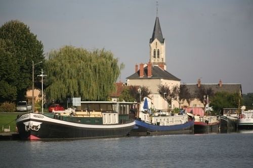
A forestry and farming area comprising the village and several hamlets situated by the banks of the rivers Aubois and Loire, some 25 miles (40 km) east of Bourges, at the junction of the D44 and the D81 roads. The commune has a small port on the Loire lateral canal. There is a canal boatyard with dry dock in the basin. The village grew up because of the canal traffic. The junction of the Canal Lateral a la Loire, a through route from the Channel to the Mediterranean, with the Canal de Berry. The canal de Berry was a small scale canal and goods needed transfering from the larger Freycinet size peniches used on the Canal de Berry to the smaller Berrichon peniches. It ran from this village to join the Loire at Tours.