
OS grid reference SO399765 Post town CRAVEN ARMS | Sovereign state United Kingdom Postcode district SY7 0 | |
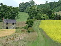 | ||
Marlow is a hamlet in north Herefordshire, England.
Map of Marlow, Craven Arms, UK
It lies in the civil parish of Leintwardine, on the B4385 road 1.2 miles (1.9 km) north of that village. The River Clun flows to the west. Immediately to the north and west is the border with Shropshire. On the other side of the Clun (and in Shropshire) is the hamlet of Broadward. Between Marlow and Leintwardine is Stormer Hall. A Roman road runs just to the east of the hamlet; it is today a footpath only.
The placename derives from "place on the boundary hill".
There is a Royal Mail post box in the hamlet.
References
Marlow, Herefordshire Wikipedia(Text) CC BY-SA