
NECTA Hartford Incorporated 1803 Elevation 164 m Zip code 06447 | Region Capitol Region Time zone Eastern (UTC-5) Founded 1803 Population 6,404 (2010) | |
 | ||
Weather -11°C, Wind W at 10 km/h, 61% Humidity | ||
Marlborough is a town in Hartford County, Connecticut, United States. It contains the census-designated place (CDP) of Terramuggus. The town's population was 6,404 at the 2010 census. Marlborough is an upper class suburban and rural community. The local high school is RHAM High School. In 2013, Marlborough ranked third (of 24) in Connecticut Magazine's biannual ranking of Connecticut small towns, median home sale price between $175,000 and $224,999.
Contents
- Map of Marlborough CT 06447 USA
- Geography
- Demographics
- History
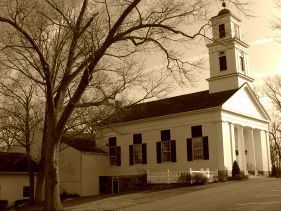
- Notable people past and present
- Points of interest
- References
Map of Marlborough, CT 06447, USA
Geography
According to the United States Census Bureau, the town has a total area of 23.5 square miles (60.9 km2), of which 23.4 square miles (60.5 km2) is land and 0.15 square miles (0.4 km2), or 0.73%, is water. Marlborough is adjacent to four other Connecticut towns (Glastonbury to the north, East Hampton to the west, Colchester to the south, and Hebron to the east). East Hampton, Colchester and Hebron are each in different counties from each other and from Marlborough.
Route 2, a two-lane highway (sometimes three) in most sections, bisects the town, and there are three Marlborough exits, at South Main Street, Route 66, and West Road, although there are exits westbound only for South Main and eastbound only for West Road. It takes approximately 15– 20 minutes to get to Hartford, 40 minutes to New London, 45 minutes to New Haven, and 40 minutes to Springfield, MA. Marlborough is generally equidistant between Boston and New York. Boston is an hour and 45 minutes away, while New York City is a two-hour car ride, pending traffic conditions. Popular vacation areas are also reasonable drives from Marlborough. The Berkshire Mountains are an hour and 20 minutes away, and popular Rhode Island beaches, depending on which one you go to, are an hour (Misquamicut, Westerly) to an hour and 20 minutes away (Narragansett).
Demographics
As of the census of 2010, there were 6,404 people, 2,292 households, and 1,820 families residing in the town. As of the 2000 census, the population density was 245.2 people per square mile (94.7/km²). There were 2,057 housing units at an average density of 88.4 per square mile (34.1/km²). The racial makeup of the town was 95.3% White, 1.3% African American, 0.1% Native American, 1.6% Asian, 0.2% from other races, and 1.4% from two or more races. Hispanic or Latino of any race were 2.8% of the population.
There were 2,292 households out of which 36.9% had children under the age of 18 living with them, 68.9% were married couples living together, 7.5% had a female householder with no husband present, and 20.6% were non-families. 15.8% of all households were made up of individuals and 5.8% had someone living alone who was 65 years of age or older. The average household size was 2.75 and the average family size was 3.09.
In the town, the population was spread out with 27.4% under the age of 18, 3.4% from 20 to 24, 22.7% from 25 to 44, 34.1% from 45 to 64, and 12.5% who were 65 years of age or older. The median age was 43 years. According to the Connecticut Economic Resource Center the 2008 median household income in Marlborough was $125,917.
The median income for a household in the town was $105,265, and the median income for a family was $120,346. Males had a median income of $78,789 versus $64,959 for females. The per capita income for the town was $49,605. About 0.4% of families and 1.1% of the population were below the poverty line, including none of those under age 18 and 1.5% of those age 65 or over.
History
The beginnings of the town can be traced back to the opening of Sadler's Ordinary in 1648—which is still in business today. Formerly a crossroads of sorts, travelers would stop to rest at the heart of what is now Marlborough center during colonial times, and eventually a petition was filed to the colonial government to form an Ecclesiastical Society in 1747. Marlborough was incorporated on 13 October 1803 with land from parts of three neighboring towns: Glastonbury, Colchester (New London County) and Hebron (Tolland County). A complete town history called Reflections Into Marlborough's History was published in 2007.