
Barangays ZIP code 6546 Local time Monday 12:34 PM | District Lone district Time zone PST (UTC+8) Area 27.83 km² | |
 | ||
Weather 27°C, Wind N at 6 km/h, 76% Humidity | ||
One breath no tank a freedive feat sambawan island maripipi biliran
Maripipi, officially the Municipality of Maripipi (Waray: Bungto san Maripipi; Cebuano: Lungsod sa Maripipi; Filipino: Bayan ng Maripipi), is a municipality in the province of Biliran in the Eastern Visayas (Region VIII) of the Philippines. The population was 7,159 at the 2015 census. In the 2016 electoral roll, it had 4,764 registered voters.
Contents
- One breath no tank a freedive feat sambawan island maripipi biliran
- Map of Maripipi Biliran Philippines
- Sambawan and maripipi islands biliran
- Geography
- Barangays
- Demographics
- References
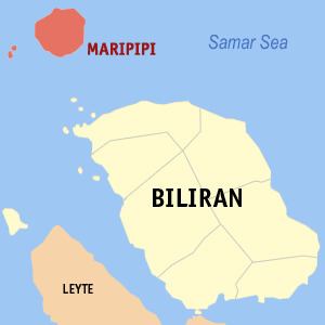
Map of Maripipi, Biliran, Philippines
Sambawan and maripipi islands biliran
Geography
Maripipi is located at 11°47′N 124°21′E, composed of Maripipi Island and surrounding islets situated northwest off the coast of Biliran Island.
According to the Philippine Statistics Authority, the municipality has a land area of 27.83 square kilometres (10.75 sq mi) constituting 7000519000000000000♠5.19% of the 536.01-square-kilometre- (206.95 sq mi) total area of Biliran.
Barangays
Maripipi is politically subdivided into 15 barangays.
Demographics
In the 2015 census, Maripipi had a population of 7,159. The population density was 260 inhabitants per square kilometre (670/sq mi).
In the 2016 electoral roll, it had 4,764 registered voters.