
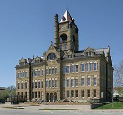
Founded 1845 Population 33,252 (2013) | Website www.co.marion.ia.us Area 1,479 km² University Central College | |
 | ||
Cities | ||
Marion County is a county located in the U.S. state of Iowa. As of the 2010 census, the population was 33,309. The county seat is Knoxville. It is named for Francis Marion, a brigadier general from South Carolina in the American Revolutionary War.
Contents
- Map of Marion County IA USA
- Geography
- Major highways
- Adjacent counties
- 2010 census
- 2000 census
- Unincorporated communities
- Population ranking
- References
Map of Marion County, IA, USA
Geography
According to the U.S. Census Bureau, the county has a total area of 571 square miles (1,480 km2), of which 555 square miles (1,440 km2) is land and 16 square miles (41 km2) (2.8%) is water.
Major highways
Adjacent counties
2010 census
The 2010 census recorded a population of 33,309 in the county, with a population density of 60.1018/sq mi (23.2054/km2). There were 13,914 housing units, of which 12,723 were occupied.
2000 census
As of the census of 2000, there were 32,052 people, 12,017 households, and 8,532 families residing in the county. The population density was 58 people per square mile (22/km²). There were 12,755 housing units at an average density of 23 per square mile (9/km²). The racial makeup of the county was 97.46% White, 0.42% Black or African American, 0.19% Native American, 1.03% Asian, 0.04% Pacific Islander, 0.22% from other races, and 0.64% from two or more races. 0.80% of the population were Hispanic or Latino of any race.
There were 12,017 households out of which 33.00% had children under the age of 18 living with them, 61.20% were married couples living together, 6.90% had a female householder with no husband present, and 29.00% were non-families. 25.60% of all households were made up of individuals and 11.90% had someone living alone who was 65 years of age or older. The average household size was 2.50 and the average family size was 3.02.
In the county, the population was spread out with 25.30% under the age of 18, 10.20% from 18 to 24, 26.50% from 25 to 44, 22.10% from 45 to 64, and 15.90% who were 65 years of age or older. The median age was 37 years. For every 100 females there were 98.60 males. For every 100 females age 18 and over, there were 95.80 males.
The median income for a household in the county was $42,401, and the median income for a family was $50,052. Males had a median income of $36,460 versus $25,573 for females. The per capita income for the county was $18,717. About 5.20% of families and 7.60% of the population were below the poverty line, including 8.70% of those under age 18 and 10.80% of those age 65 or over.
Unincorporated communities
Population ranking
The population ranking of the following table is based on the 2010 census of Marion County.
† county seat