
Established 13 December 1985 Area 2,616 km² | Districts 5 Time zone GMT (UTC+0) Population 199,689 (2008) | |
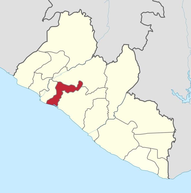 | ||
Margibi county liberia west africa
Margibi is a county on the north to central coast of Liberia. One of 15 counties that constitute the first-level of administrative division in the nation, it has five districts. Kakata serves as the capital with the area of the county measuring 2,616 square kilometres (1,010 sq mi). As of the 2008 Census, it had a population of 199,689, making it the sixth most populous county in Liberia.
Contents
- Margibi county liberia west africa
- Map of Margibi Liberia
- Geography
- Demographics
- History
- Economy
- Administration
- References
Map of Margibi, Liberia
Margibi's County Superintendent is John Zubah Buway. The county is bordered by Montserrado County to the west, Grand Bassa County to the east, and Bong County on the north. The southern part of Margibi lies on the Atlantic Ocean.
The County also has a strong Civil Society structure that pressure the County Authority to act timely and account for their actions. Mr. Edwin Friday Crusor, Sr. is the Coordinator of the National Civil Society Coulcil of Liberia (NCSCL) Margibi Chapter whose responsibility is to coordinate/supervise the opperation of CBOs, NGOs and other Civic/Civil Institutions operating in Margibi County.
Geography
Margibi County has a National proposed reserve in Margibi Mangrove, occupy an area of 23,818 ha (58,860 acres). The county has coastal plains that raises to a height of 30 m (98 ft) above the sea-level inward to a distance of 25 km (16 mi). These plains receive a very high rainfall ranging from 4,450 mm (175 in) to 4,500 mm (180 in) per year and receive longer sunshine with a humidity of 85 to 95 per cent. It is swampy along rivers and creeks, while there are patches of Savannah woodland. Rice and cassava interplanted with Sugarcane are the major crops grown in the region. The northern or the upper part of the highland has tropical forest which is usually 30 m (98 ft) above the mean sea level. The regions receive a bimodal rainfall with a gap of two weeks in between. Cocoa, coffee, Lofa, bong, Nimba, rubber, citrus oil and palm are the most common crops in the region.
Demographics
As of 2008, the county had a population of 209,923, comprising of 105,840 males and 104,083 females. The sex ratio was 101.7 compared to 100.9 in 1994 census. The number of households during 2008 was 19,254 and the average size of the households was 4.6. The population was 7.20 per cent of the total population, while it was 6.00 per cent in 1994. The county had an area of 1,039 sq mi and the density per sq.mi was 202. The density during the 1984 census stood at 146. Liberia experienced civil war during various times and the total number of people displaced on account of wars as of 2008 in the county was 46,663. The number of people residing in urban areas was 88,868, with 43,723 males and 45,145 females. The total number of people in rural areas was 121,055, with 62,117 males and 58,938 females. The total fraction of people residing in urban areas was 42.33 per cent, while the remaining 058 per cent were living in rural areas. The number of people resettled as of 2008 was 29,813 while the number of people who were not resettled was 1,754. The number of literates above the age of ten as of 2008 was 55,994 while the number of illiterates was 39,112 making the literacy rate to 58.88. The total number of literate males was 33,596 while the total number of literate females was 22,398.
History
Margibi County is one the latest set of counties created in 1985 by an Interim National Assembly decree dated December 13, 1985. During the Civil war, the county is the one of the largest to have maximum displacements. An estimated 200,000 people were displaced in the county between Konala and Kakata. The county was creating by merging the territories of Marshall and Gibi. The county was traditionally inhabited by Bassa tribe. Kpelle, a southwestern Membe speaking people are another tribe who reside in the region.
Economy
As of 2011, the area of rice plantation was 6,170 ha (15,200 acres), which was 2.584 per cent of the total area of rice planted in the country. The total production stood at 7000 metric tonnes. As of 2011, the number of Cassava plantation was 6070, which was 5 per cent of the total area of Cassava planted in the country. The total production stood at 760 metric tonnes. The number of Cocoa plantation was 760, which was 2 per cent of the total area of Cassava planted in the country. The number of rubber plantation was 3680, which was 5.9 per cent of the total area of Cassava planted in the country. The number of Coffee plantation was 340, which was 1.5 per cent of the total area of Cassava planted in the country. As of 2008, the county had 14,872 paid employees, 27,567 self-employed people, 19,298 family workers, 7,048 people looking for work, 9,193 not working people, 23,012 people working in households, 40,953 students, 1,330 retired people, 2,789 incapacitated people, 3,227 part-time workers and 20,954 others, making the total working population of 170,243.
Administration
Districts of Margibi County include (2008 population):Firestone District (57,251), Gibi District (13,232), Kakata District (88,130) and Mambah-Kaba District (41,076) The Legislature of Liberia was modeled based on the Legislature of United States. It is bicameral in nature with a Senate and the House of Representatives. There are 13 counties in the country and based on the population, each county is defined to have at least two members, while the total number of members to the house including the Speaker being 64. Each member represents an electoral district and elected to a six year term based on popular vote. There were 26 senators, two each for the 13 counties and they serve a nine year term (30 senators, 15 counties and nine years from 2011). Senators are also elected based on plurality of votes. The Vice-President is the head of the Senate and he also acts as President in his absence.