
 | ||
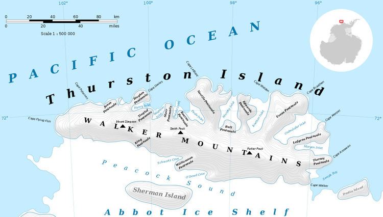
Marck Glacier (72°16′S 97°2′W) is a glacier flowing into the southwestern extremity of Cadwalader Inlet on the north side of Thurston Island, Antarctica. It was named by the Advisory Committee on Antarctic Names after Aviation Machinist's Mate George H. Marck, an aircrewman in the Eastern Group of U.S. Navy Operation Highjump, which obtained aerial photographs of Thurston Island and adjacent coastal areas in the summer of 1946–47.
Contents
Map of Marck Glacier, Antarctica
Maps
References
Marck Glacier Wikipedia(Text) CC BY-SA