
 | ||
Mapping L.A. is a project of the Los Angeles Times, beginning in 2009, to draw boundary lines for 158 cities and unincorporated places within the Los Angeles County, California, 114 neighborhoods within the City of Los Angeles and 42 unincorporated areas where the statistics were merged with adjacent cities.
Contents
History
The project began in February 2009 with the posting online of the first version of boundary lines for eighty-seven Los Angeles city neighborhoods. The map was then "redrawn with the help of readers who agreed or disagreed with our initial boundaries." The media company said: "After reviewing this collective knowledge, Times staffers adjusted more than 100 boundaries, eliminated some names and added others."
According to the Times, the project "was created by the Data Desk, a team of reporters and Web developers in downtown L.A."
Scope
The Times said that the Mapping L.A. project became the media company's "resource for neighborhood boundaries, demographics, crime and schools." The results as posted are searchable by address and ZIP code or by individual neighborhood. It noted that:
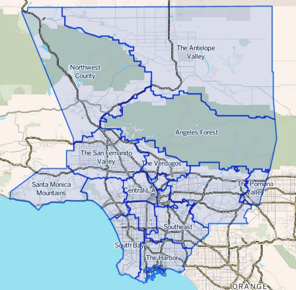
The maps cover the 4,000 square miles of Los Angeles County — by far the most populous county in the nation — from the high desert to the coast. In 2009, there were an estimated 9.8 million residents, up from 9.5 million counted in the 2000 U.S. census, the basis for The Times’ demographic analysis for each neighborhood and region. Unlike most other attempts at mapping L.A., this one follows a set of principles intended to make it visually and statistically coherent. It gathers every block of the city into reasonably compact areas leaving no enclaves, gaps, overhangs or ambiguities.
Categories
The website provides the following categories, among others: