
Local time Monday 2:24 PM | ||
 | ||
Weather 12°C, Wind W at 14 km/h, 46% Humidity | ||
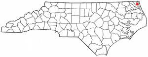
Maple is an unincorporated community in Crawford Township, Currituck County, North Carolina, United States at the intersection of NC Highway 168 and SR 1246 (Maple Road). Maple is located at latitude 36.4148780 North, and longitude -76.0040925 West. The elevation is 3 feet. Maple appears on the Currituck U.S. Geological Survey Map.
Contents
- Map of Maple NC USA
- Government Education Facilities
- Nearby Cities Towns
- Regional Cities Towns
- References
Map of Maple, NC, USA
The United States Postal Service operates a post office located at 3452 Caratoke Hwy., Maple, NC. The zip code for Maple is 27956.
The community of Maple is bounded on the east by Coinjock Bay, a tributary of Currituck Sound; on the west by the Great Swamp; on the south by the unincorporated community of Barco, NC and on the north by the unincorporated community of Currituck, NC
Government / Education Facilities
Maple is home to the following local governmental/education facilities: