
Census division 2 Postal code span T0K 1L0 Local time Monday 10:18 AM Waterway Pakowki Lake | Time zone MST (UTC-7) Elevation 930 m | |
 | ||
Weather 0°C, Wind N at 6 km/h, 62% Humidity | ||
Manyberries is a hamlet in Alberta, Canada within the County of Forty Mile No. 8. It is located approximately 85 km (53 mi) south of Medicine Hat, at the eastern end of Highway 61 (the Red Coat Trail).
Contents
Map of Manyberries, AB, Canada
Services
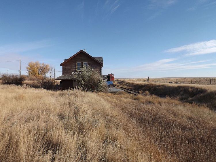
Manyberries has a community hall, a curling rink, a park with playground equipment, and a hotel with lounge. Manyberries still has its original Canadian Pacific railway station and a section house, which are both private residences, and are located beside the former Stirling-Weyburn branch line. CPR abandoned the branch line from just east of Stirling to Consul, Saskatchewan in the late 1980s. The tracks were pulled shortly after in early 1990s from Manyberries to Consul. The hamlet also has two oilfield services company that service the nearby Manyberries oilfield.
Climate
Manyberries experiences a semi-arid climate (Köppen climate classification BSk). Winters are long, cold and dry, while summers are relatively short but very warm. Precipitation is low, with an annual average of 353 mm, and is concentrated in the warmer months. Manyberries is considered the sunniest spot in Canada with the highest average annual hours of sunlight at 2,567.