
Country United States County Somerset Elevation 56 ft (17 m) Zip code 08835 Local time Monday 11:49 AM | Incorporated April 18, 1929 Area 6.342 km² Population 10,424 (2013) | |
 | ||
Area rank 376th of 566 in state15th of 21 in county Weather 7°C, Wind N at 10 km/h, 37% Humidity | ||
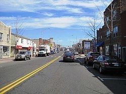
Fiat dealer manville new jersey 08835
Manville is a borough in Somerset County, New Jersey, United States. As of the 2010 United States Census, the borough's population was 10,344, reflecting an increase of one person (+0.0%) from the 10,343 counted in the 2000 Census, which had in turn declined by 224 (-2.1%) from the 10,567 counted in the 1990 Census. Manville was named after the Johns-Manville Corporation, which maintained a large manufacturing facility in the borough for decades.
Contents
- Fiat dealer manville new jersey 08835
- Map of Manville NJ 08835 USA
- Geography
- Census 2010
- Census 2000
- Local government
- Federal state and county representation
- Politics
- Education
- Roads and highways
- Public transportation
- Rail
- Redevelopment
- Flooding problems
- Hurricane Floyd flood of 1999
- Lost Valley flooding
- Flood gauge on Raritan River
- Notable people
- References
Map of Manville, NJ 08835, USA
Historically, many of Manville's residents are of Slavic — mostly eastern Polish (23.1% of the borough's population in 2000) and western Ukrainian descent — with many businesses and restaurants geared towards the Polish-American community located along Main Street (County Route 533).
Manville was formed by an act of the New Jersey Legislature on April 1, 1929, subject to the results of a referendum held on April 18, 1929.
Geography
According to the United States Census Bureau, the borough had a total area of 2.449 square miles (6.342 km2), including 2.361 square miles (6.114 km2) of land and 0.088 square miles (0.228 km2) of water (3.60%).
Unincorporated communities, localities and place names located partially or completely within the borough include Millsboro.
The borough borders Bridgewater Township, Franklin Township and Hillsborough Township.
Much of Manville is in a low-lying flood plain and is surrounded by rivers and streams on all but the western side which borders neighboring Hillsborough Township by land. The Raritan River forms the northern boundary of the borough and is met by the Millstone River which forms the eastern boundary of the borough, where a weir exists at the confluence of the rivers which is used for water intake purposes by New Jersey American Water.
Census 2010
The 2010 United States Census counted 10,344 people, 4,016 households, and 2,663 families residing in the borough. The population density was 4,382.0 per square mile (1,691.9/km2). The borough contained 4,277 housing units at an average density of 1,811.9 per square mile (699.6/km2). The racial makeup of the borough was 86.35% (8,932) White, 2.72% (281) Black or African American, 0.10% (10) Native American, 1.99% (206) Asian, 0.00% (0) Pacific Islander, 6.50% (672) from other races, and 2.35% (243) from two or more races. Hispanics or Latinos of any race were 18.98% (1,963) of the population.
Out of a total of 4,016 households, 26.8% had children under the age of 18 living with them, 47.2% were married couples living together, 12.6% had a female householder with no husband present, and 33.7% were non-families. 27.0% of all households were made up of individuals, and 11.0% had someone living alone who was 65 years of age or older. The average household size was 2.58 and the average family size was 3.12.
In the borough, 20.2% of the population were under the age of 18, 9.0% from 18 to 24, 28.6% from 25 to 44, 28.0% from 45 to 64, and 14.2% who were 65 years of age or older. The median age was 39.6 years. For every 100 females the census counted 100.5 males, but for 100 females at least 18 years old, it was 99.3 males.
The Census Bureau's 2006-2010 American Community Survey showed that (in 2010 inflation-adjusted dollars) median household income was $55,601 (with a margin of error of +/- $4,325) and the median family income was $63,864 (+/- $11,426). Males had a median income of $48,356 (+/- $4,062) versus $40,954 (+/- $5,868) for females. The per capita income for the borough was $26,636 (+/- $1,894). About 1.9% of families and 4.6% of the population were below the poverty line, including 8.4% of those under age 18 and 3.2% of those age 65 or over.
Census 2000
As of the 2000 United States Census there were 10,343 people, 4,115 households, and 2,757 families residing in the borough. The population density was 4,167.5 people per square mile (1,610.3/km2). There were 4,296 housing units at an average density of 1,731.0 per square mile (668.8/km2). The racial makeup of the borough was 95.99% White, 0.45% African American, 0.07% Native American, 1.31% Asian, 0.03% Pacific Islander, 1.14% from other races, and 1.01% from two or more races. Hispanic or Latino of any race were 5.40% of the population.
23.1% of Manville's residents identified themselves as being of Polish ancestry, the second-highest in New Jersey (behind Wallington's 45.5%), for all places with 1,000 people listing their ancestry.
There were 4,115 households out of which 26.5% had children under the age of 18 living with them, 50.3% were married couples living together, 11.9% had a female householder with no husband present, and 33.0% were non-families. 26.7% of all households were made up of individuals and 12.3% had someone living alone who was 65 years of age or older. The average household size was 2.51 and the average family size was 3.05.
In the borough the population was spread out with 20.7% under the age of 18, 7.2% from 18 to 24, 31.9% from 25 to 44, 22.5% from 45 to 64, and 17.7% who were 65 years of age or older. The median age was 40 years. For every 100 females there were 96.2 males. For every 100 females age 18 and over, there were 94.0 males.
The median income for a household in the borough was $51,258, and the median income for a family was $61,151. Males had a median income of $40,902 versus $32,030 for females. The per capita income for the borough was $23,293. About 2.1% of families and 3.8% of the population were below the poverty line, including 3.8% of those under age 18 and 4.8% of those age 65 or over.
Local government
Manville is governed under the Borough form of New Jersey municipal government. The governing body consists of a Mayor and a Borough Council comprising six council members, with all positions elected at-large on a partisan basis as part of the November general election. A Mayor is elected directly by the voters to a four-year term of office. The Borough Council consists of six members elected to serve three-year terms on a staggered basis, with two seats coming up for election each year in a three-year cycle. The Borough form of government used by Manville, the most common system used in the state, is a "weak mayor / strong council" government in which council members act as the legislative body with the mayor presiding at meetings and voting only in the event of a tie. The mayor can veto ordinances subject to an override by a two-thirds majority vote of the council. The mayor makes committee and liaison assignments for council members, and most appointments are made by the mayor with the advice and consent of the council.
As of 2016, the Mayor of Manville is Republican Richard M. Onderko, having been elected to succeed Mayor Angelo Corradino. Mayor Onderko's term ends December 31, 2019. Members of the Manville Borough Council are Council President Steven Szabo (R, 2017), Susan Asher (R, 2016), Dayna Camacho (R, 2017), Mike Kassick (R, 2016), Michele Magnani (R, 2018) and Theodore Petrock, III (R, 2018). The 2016 governing body was the first all-Republican Council and Mayor in Manville's history.
Preceding Mayor Onderko was Mayor Angelo Corradino, the only five-term Mayor in Manville's history, the first Manville Mayor to be elected as the President of the New Jersey Conference of Mayors and the first Manville Mayor to be elected into the New Jersey Mayors Hall of Fame.
Federal, state and county representation
Manville is located in the 12th Congressional District and is part of New Jersey's 16th state legislative district. Prior to the 2010 Census, Manville had been part of the 7th Congressional District, a change made by the New Jersey Redistricting Commission that took effect in January 2013, based on the results of the November 2012 general elections.
New Jersey's Twelfth Congressional District is represented by Bonnie Watson Coleman (D, Ewing Township). New Jersey is represented in the United States Senate by Cory Booker (D, Newark, term ends 2021) and Bob Menendez (D, Paramus, 2019).
For the 2016–2017 session (Senate, General Assembly), the 16th Legislative District of the New Jersey Legislature is represented in the State Senate by Christopher Bateman (R, Branchburg) and in the General Assembly by Jack Ciattarelli (R, Hillsborough Township) and Andrew Zwicker (D, South Brunswick). The Governor of New Jersey is Chris Christie (R, Mendham Township). The Lieutenant Governor of New Jersey is Kim Guadagno (R, Monmouth Beach).
Somerset County is governed by a five-member Board of Chosen Freeholders, whose members are elected at-large to three-year terms of office on a staggered basis, with one or two seats coming up for election each year. At an annual reorganization meeting held in the beginning of January, the board selects a Director and Deputy Director from among its members. As of 2016, Somerset County's Freeholders are Freeholder Director Patricia L. Walsh (R, Green Brook Township, term ends December 31, 2016), Freeholder Deputy Director Peter S. Palmer (R, Bernardsville, 2017), Patrick Scaglione (R, Bridgewater Township, 2018), Mark Caliguire (R, Skillman in Montgomery Township, 2018), and Brian D. Levine (R, Franklin Township, 2017), Constitutional officers elected on a countywide basis are County Clerk Brett A. Radi (R, Somerville, 2017), Sheriff Frank J. Provenzano (R, Raritan, 2016) and Surrogate Frank Bruno (R, Branchburg, 2018).
Politics
As of March 23, 2011, there were a total of 5,200 registered voters in Manville, of which 1,375 (26.4% vs. 26.0% countywide) were registered as Democrats, 1,080 (20.8% vs. 25.7%) were registered as Republicans and 2,741 (52.7% vs. 48.2%) were registered as Unaffiliated. There were 4 voters registered to other parties. Among the borough's 2010 Census population, 50.3% (vs. 60.4% in Somerset County) were registered to vote, including 63.0% of those ages 18 and over (vs. 80.4% countywide).
In the 2012 presidential election, Democrat Barack Obama received 50.0% of the vote (1,702 cast), ahead of Republican Mitt Romney with 48.2% (1,641 votes), and other candidates with 1.7% (59 votes), among the 3,449 ballots cast by the borough's 5,449 registered voters (47 ballots were spoiled), for a turnout of 63.3%. In the 2008 presidential election, Republican John McCain received 1,928 votes (50.7% vs. 46.1% countywide), ahead of Democrat Barack Obama with 1,746 votes (45.9% vs. 52.1%) and other candidates with 72 votes (1.9% vs. 1.1%), among the 3,802 ballots cast by the borough's 5,129 registered voters, for a turnout of 74.1% (vs. 78.7% in Somerset County). In the 2004 presidential election, Republican George W. Bush received 1,998 votes (52.4% vs. 51.5% countywide), ahead of Democrat John Kerry with 1,741 votes (45.7% vs. 47.2%) and other candidates with 53 votes (1.4% vs. 0.9%), among the 3,812 ballots cast by the borough's 4,881 registered voters, for a turnout of 78.1% (vs. 81.7% in the whole county).
In the 2013 gubernatorial election, Republican Chris Christie received 74.0% of the vote (1,745 cast), ahead of Democrat Barbara Buono with 24.2% (570 votes), and other candidates with 1.8% (43 votes), among the 2,402 ballots cast by the borough's 5,535 registered voters (44 ballots were spoiled), for a turnout of 43.4%. In the 2009 gubernatorial election, Republican Chris Christie received 1,594 votes (58.9% vs. 55.8% countywide), ahead of Democrat Jon Corzine with 823 votes (30.4% vs. 34.1%), Independent Chris Daggett with 210 votes (7.8% vs. 8.7%) and other candidates with 36 votes (1.3% vs. 0.7%), among the 2,704 ballots cast by the borough's 5,189 registered voters, yielding a 52.1% turnout (vs. 52.5% in the county).
Education
The Manville School District serves public school students in kindergarten through twelfth grade. As of the 2011-12 school year, the district's four schools had an enrollment of 1,297 students and 100.7 classroom teachers (on an FTE basis), for a student–teacher ratio of 12.88:1. Schools in the district (with 2011-12 enrollment data from the National Center for Education Statistics) are Weston Elementary School for grades K-3 (451 students), Roosevelt Intermediate School for grades 4&5 (182), Alexander Batcho Intermediate School for grades 6-8 (279) and Manville High School for grades 9-12 (385).
Christ the King School (PreK-8) operates under the supervision of Roman Catholic Diocese of Metuchen.
Roads and highways
As of May 2010, the borough had a total of 42.07 miles (67.71 km) of roadways, of which 39.19 miles (63.07 km) were maintained by the municipality and 2.88 miles (4.63 km) by Somerset County.
Public transportation
Somerset County provides SCOOT bus service in the borough on its R1, R2 and Peak routes.
Rail
The Norfolk Southern Railway Lehigh Line, the Conrail Shared Assets Operations Lehigh Line, and the CSX Transportation Trenton Subdivision freight lines all connected at Port Reading Junction in Manville.
Redevelopment
Johns-Manville Corporation had a large manufacturing facility in the borough that utilized asbestos in its manufacturing processes. Manville has begun to leave behind its industrial past and the lingering asbestos pollution that was a legacy of the manufacturing that took place in the borough. The asbestos dumps have been removed or capped in compliance with environmental laws, and the former manufacturing land has been redeveloped into a large movie theater complex known as Reading Cinemas, a medium-sized retail outlet with a Walmart anchor store and a used car wholesale auction company called ADESA New Jersey.
Other areas of the borough are also undergoing redevelopment. The Federal Superfund project called The Federal Creosote Site was cleaned up by the United States Environmental Protection Agency (EPA) with $250 Million of public funds. The Superfund cleanup project was performed in a 35-acre (140,000 m2) residential section of town called Claremont Development and in a 15-acre (61,000 m2) commercial area called the Rustic Mall, and was officially declared complete by the EPA on March 7, 2008. As of 2014, the borough has no plans to redevelop the former Superfund site.
Flooding problems
Manville suffers from occasional flooding events that occur after prolonged heavy rainfall events, when the Raritan River and Millstone River overflow their banks into the northern section (Raritan) and the Lost Valley section (Millstone) of the borough. The southern parts of Main Street also suffer from the flooding, due to the presence of Royce Brook which backs up with water from the nearby Millstone River in which it empties.
There are studies being undertaken to address the flooding problems in the Millstone River basin and Manville; however, none of the flood control ideas in the Millstone River basin have gotten beyond the initial study stages as of late 2006.
Hurricane Floyd flood of 1999
Manville was severely hit by a flood in the wake of Hurricane Floyd in September 1999, which dropped 10 to 12 inches (250 to 300 mm) of rain in the areas surrounding the borough. The floods devastated the Lost Valley section, some of the South side area along Main Street and a large portion of the North side. Water levels reached between 12 feet (3.7 m) and 17 feet (5.2 m) in parts of the borough on September 17, 1999. The only way residents could get help was by boat or helicopter. There was also a large amount of fuel oil floating on the flood water which further damaged homes, many of which came off their foundations.
A portion of the north side received water coming from the Raritan at Dukes Parkway. Much of the north side had no flooding. The water reached the freight tracks at Main Street, and spilled over, flooding some on the South Street side, but leaving tons of water dammed in on the North Street side, where people had to be rescued from rooftops, or second floor windows and landings, by boat.
The problem was doubled in the Lost Valley section, as flood waters backed up where the Raritan and Millstone rivers meet near the dam. All trapped and injured people had to be taken out by helicopter, as there was no way to get in or out of the Lost Valley section. The September 1999 flood disaster was the worst ever to hit Manville, although it had been flooded in 1971 during Tropical Storm Doria, when many of the Lost Valley houses were destroyed and their foundations lost, and previously before that in the 1950s. Because of the railroad tracks being so much higher than the Lost Valley land, Manville's Lost Valley will always be a number one target for flooding. Through research of Manville's history, Lost Valley was to remain open land due to the high risk of flood.
Lost Valley flooding
Manville has the distinction of being the location where the Raritan River (which passes to the north) and the tributary Millstone River (which passes to the east) join together, in the far northeastern corner of the borough. The Lost Valley section in eastern Manville is situated on the natural flood plain between the Raritan and Millstone Rivers, and bears the brunt of occasional flooding events which affect the river basins. The Lost Valley section is named so because it is generally disconnected from the rest of the borough with only a tunnel at Kyle Street and a bridge at Bridge Street crossing the railroad tracks to the neighborhood. Hurricane Floyd in September 1999 produced a particularly severe flood (a record for the river basins) in Manville, especially in the Lost Valley section of the borough, which experienced flooding all the way to the railroad tracks, with twelve feet or more water on many properties, which inundated houses with damaging flood waters. Another severe and devastating flood event occurred in Lost Valley during the April 2007 Nor'easter. It also left many homes and businesses underwater and was the worst flood since Hurricane Floyd. Flooding problems once again occurred in Manville on March 14, 2010, with rivers running already high due to recent snow melt along with three to four inches (102 mm) of rain that fell on the area on March 13, flooding was inevitable. More extensive flooding affected Manville in August 2011 when Hurricane Irene passed through New Jersey. In the aftermath of Hurricane Sandy in late October 2012, Manville did not flood but the powerful winds left many homes without power for several days.
Flood gauge on Raritan River
Flooding occurs at a 14-foot (4.3 m) stage, and severe flooding occurs when the water reaches 18 feet (5.5 m). The National Oceanic and Atmospheric Administration provides access to real time river level data.
Notable people
People who were born in, residents of, or otherwise closely associated with Manville include: