
NRHP Reference # 90001788 Added to NRHP 7 December 1990 | Architect Jacob Rohm Phone +1 765-344-0741 | |
 | ||
MPS Grain Mills in Indiana MPS Address 6087 Mill Rd, Carbon, IN 47837, USA Similar Mansfield Covered Bridge, Narrows Covered Bridge, Raccoon Lake State Recreatio, Cox Ford Bridge, Mecca Bridge | ||
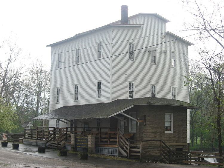
Mansfield roller mill and weir
The Mansfield Roller Mill or Mansfield Mill is a (gristmill) that was built in Mansfield, Indiana, United States by James Kelsey and Francis Dickson in 1820; it has always run on water power from Big Racoon Creek. The original mill was a 30-foot (9.1 m) by 30-foot (9.1 m) log building.
Contents
- Mansfield roller mill and weir
- Before and after mansfield roller mill dam video shoot
- History
- Geographic Coordinates
- References
According to legend, glacial stones from a nearby farm were used for grinding. In the mid-19th century a sash saw mill and a carding mill were added to the grist mill. The mill is a state historic site still in operation. The Mansfield Roller Mill now runs by water turbine engines.
Before and after mansfield roller mill dam video shoot
History
Between 1973 and 1978 Tex Kelly (Edward Earl Terry (actor)) "The Bad Man of the movies" purchased the Mansfield Roller Mill and several other buildings and attempt to fulfill his dream of turning the town into Frontier City. His efforts failed and in 1979, Tex and Isabel returned to Tex's hometown of Coxville, Indiana and opened "Tex's Longhorn Tavern".
Owners Jack & Shirley Dalton and Frank & Sharon Hutcheson donated the mill to the Indiana Department of Natural Resources, Division of State Museums and Historic Sites in 1995.
The Mansfield Roller Mill is located at the corner of Mansfield Rd. (historic) and Big Raccoon Creek in Mansfield IN 47872, just southeast of Rockville, Indiana.
Mansfield Road (historic) is now called by several names depending on the map date: