
Country United States Incorporated February 21, 1798 Area 97.71 km² Local time Monday 4:40 AM | Mentioned May 12, 1701 Elevation 9.14 m Population 1,559 (2000) Area code 856 | |
 | ||
Area rank 62nd of 566 in state4th of 15 in county Weather 2°C, Wind NW at 11 km/h, 72% Humidity Neighborhoods Portertown, Acton, Welchville | ||
Mannington Township is a township in Salem County, New Jersey, United States. As of the 2010 United States Census, the township's population was 1,806, reflecting an increase of 247 (+15.8%) from the 1,559 counted in the 2000 Census, which had in turn declined by 134 (-7.9%) from the 1,693 counted in the 1990 Census.
Contents
- Map of Mannington Township NJ USA
- History
- Geography
- Census 2010
- Census 2000
- Economy
- Local government
- Federal state and county representation
- Politics
- Education
- Roads and highways
- Public transportation
- Notable people
- References
Map of Mannington Township, NJ, USA
History
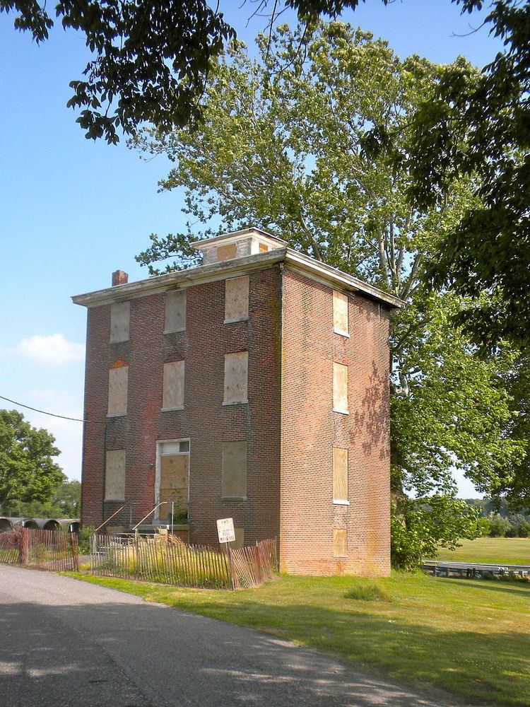
Mannington Township was first mentioned on May 12, 1701. It had been previously known as East Fenwick Township, which was mentioned on September 3, 1679, though the details of its incorporation are unknown. The township was incorporated by New Jersey Legislature's Township Act of 1798 on February 21, 1798 as one of New Jersey's original group of 104 townships. A portion of the township was taken in 1878 and annexed by Quinton Township. The township's name derives from the Lenape deity, variously spelled as Maneto or Manito.
As a dry town, the sale of alcohol is prohibited.
Geography
According to the United States Census Bureau, the township had a total area of 37.725 square miles (97.708 km2), including 33.704 square miles (87.294 km2) of land and 4.021 square miles (10.414 km2) of water (10.66%).
The Salem River flows along the township's northern and western boundaries.
The township borders the Salem County municipalities of Alloway Township, Carneys Point Township, Pennsville Township, Pilesgrove Township, Quinton Township and Salem.
Unincorporated communities, localities and place names located partially or completely within the township include Acton, Halltown, Marshalltown, Pointers, Portertown, Slapes Corner, Welchtown and Welchville.
Census 2010
The 2010 United States Census counted 1,806 people, 540 households, and 392 families residing in the township. The population density was 53.6 per square mile (20.7/km2). The township contained 592 housing units at an average density of 17.6 per square mile (6.8/km2). The racial makeup of the township was 72.59% (1,311) White, 21.10% (381) Black or African American, 0.66% (12) Native American, 0.44% (8) Asian, 0.00% (0) Pacific Islander, 3.93% (71) from other races, and 1.27% (23) from two or more races. Hispanics or Latinos of any race were 8.19% (148) of the population.
Out of a total of 540 households, 27.4% had children under the age of 18 living with them, 58.0% were married couples living together, 10.2% had a female householder with no husband present, and 27.4% were non-families. 22.6% of all households were made up of individuals, and 9.8% had someone living alone who was 65 years of age or older. The average household size was 2.65 and the average family size was 3.09.
In the township, 18.3% of the population were under the age of 18, 10.3% from 18 to 24, 26.7% from 25 to 44, 27.2% from 45 to 64, and 17.4% who were 65 years of age or older. The median age was 41.4 years. For every 100 females the census counted 141.8 males, but for 100 females at least 18 years old, it was 143.0 males.
The Census Bureau's 2006-2010 American Community Survey showed that (in 2010 inflation-adjusted dollars) median household income was $63,650 (with a margin of error of +/- $5,287) and the median family income was $75,625 (+/- $17,613). Males had a median income of $59,896 (+/- $6,020) versus $42,159 (+/- $10,096) for females. The per capita income for the borough was $33,369 (+/- $5,096). About 6.1% of families and 6.7% of the population were below the poverty line, including 10.2% of those under age 18 and 8.2% of those age 65 or over.
Census 2000
As of the 2000 United States Census there were 1,559 people, 539 households, and 409 families residing in the township. The population density was 44.8 people per square mile (17.3/km²). There were 573 housing units at an average density of 16.5 per square mile (6.4/km²). The racial makeup of the township was 75.63% White, 20.91% African American, 0.51% Native American, 0.38% Asian, 1.73% from other races, and 0.83% from two or more races. Hispanic or Latino of any race were 3.34% of the population.
There were 539 households out of which 26.5% had children under the age of 18 living with them, 60.9% were married couples living together, 10.4% had a female householder with no husband present, and 24.1% were non-families. 20.6% of all households were made up of individuals and 10.0% had someone living alone who was 65 years of age or older. The average household size was 2.63 and the average family size was 3.02.
In the township the population was spread out with 22.6% under the age of 18, 4.8% from 18 to 24, 25.5% from 25 to 44, 23.7% from 45 to 64, and 23.4% who were 65 years of age or older. The median age was 43 years. For every 100 females there were 95.9 males. For every 100 females age 18 and over, there were 88.6 males.
The median income for a household in the township was $52,625, and the median income for a family was $62,500. Males had a median income of $45,714 versus $29,727 for females. The per capita income for the township was $24,262. About 3.8% of families and 6.9% of the population were below the poverty line, including 11.5% of those under age 18 and 8.1% of those age 65 or over.
Economy
Mannington Mills operates a manufacturing facility which occupies over 500 acres (200 ha), which it moved to Mannington after the company was established in Salem in 1915. In 2010, the company undertook an extensive cleanup of contaminated soil on the plant site.
Local government
Mannington Township is governed under the Township form of government. The governing body is a three-member Township Committee, whose members are elected directly by the voters at-large in partisan elections to serve three-year terms of office on a staggered basis, with one seat coming up for election each year as part of the November general election in a three-year cycle. At an annual reorganization meeting conducted during the first week of January, the Township Committee selects one of its members to serve as Mayor and another as Deputy Mayor.
As of 2016, members of the Mannington Township Committee are Mayor John R. Emel (D, term on committee ends December 21, 2018; term as mayor ends 2016), Deputy Mayor Dante C. Spina Sr. (D, term on committee ends 2017; term as deputy mayor ends 2016) and Donald C. Asay (R, 2016).
In the 2012 general election, the Township Committee had Democrats in the majority for the first time in township history, though the committee decided to choose the committee's only Republican, Donald C. Asay, as mayor.
Federal, state and county representation
Mannington Township is located in the 2nd Congressional District and is part of New Jersey's 3rd state legislative district.
New Jersey's Second Congressional District is represented by Frank LoBiondo (R, Ventnor City). New Jersey is represented in the United States Senate by Cory Booker (D, Newark, term ends 2021) and Bob Menendez (D, Paramus, 2019).
For the 2016–2017 session (Senate, General Assembly), the 3rd Legislative District of the New Jersey Legislature is represented in the State Senate by Stephen M. Sweeney (D, West Deptford Township) and in the General Assembly by John J. Burzichelli (D, Paulsboro) and Adam Taliaferro (D, Woolwich Township). The Governor of New Jersey is Chris Christie (R, Mendham Township). The Lieutenant Governor of New Jersey is Kim Guadagno (R, Monmouth Beach).
Salem County is governed by a seven-member Board of Chosen Freeholders who are elected at-large to serve three-year terms of office on a staggered basis, with either two or three seats coming up for election each year. At an annual reorganization meeting held in the beginning of January, the board selects a Director and a Deputy Director from among its members. As of 2014, Salem County's Freeholders (with party, residence, term-end year and committee chairmanship listed in parentheses) are Director Julie A. Acton (R, Pennsville Township, 2016; Administration), Deputy Director Dale A. Cross (R, Pennsville Township, 2014; Public Safety), Bruce L. Bobbitt (D, Pilesgrove Township, 2014; Public Services), Ben Laury (R, Elmer, 2015; Public Works) Beth E. Timberman (D, Woodstown, 2015; Social Services), Robert J. Vanderslice (R, Pennsville Township, 2014; Health and Human Services) Lee R. Ware (D, Elsinboro Township, 2016; Transportation, Agriculture and Cultural Affairs). Constitutional officers elected on a countywide basis are County Clerk Gilda T. Gill (2014), Sheriff Charles M. Miller (2015) and Surrogate Nicki A. Burke (2015).
Politics
As of March 23, 2011, there were a total of 1,014 registered voters in Mannington Township, of which 243 (24.0% vs. 30.6% countywide) were registered as Democrats, 285 (28.1% vs. 21.0%) were registered as Republicans and 486 (47.9% vs. 48.4%) were registered as Unaffiliated. There were no voters registered to other parties. Among the township's 2010 Census population, 56.1% (vs. 64.6% in Salem County) were registered to vote, including 68.7% of those ages 18 and over (vs. 84.4% countywide).
In the 2012 presidential election, Republican Mitt Romney received 55.8% of the vote (406 cast), ahead of Democrat Barack Obama with 42.1% (306 votes), and other candidates with 2.1% (15 votes), among the 734 ballots cast by the township's 1,036 registered voters (7 ballots were spoiled), for a turnout of 70.8%. In the 2008 presidential election, Republican John McCain received 394 votes (52.0% vs. 46.6% countywide), ahead of Democrat Barack Obama with 349 votes (46.0% vs. 50.4%) and other candidates with 10 votes (1.3% vs. 1.6%), among the 758 ballots cast by the township's 1,018 registered voters, for a turnout of 74.5% (vs. 71.8% in Salem County). In the 2004 presidential election, Republican George W. Bush received 414 votes (55.3% vs. 52.5% countywide), ahead of Democrat John Kerry with 324 votes (43.3% vs. 45.9%) and other candidates with 5 votes (0.7% vs. 1.0%), among the 748 ballots cast by the township's 1,021 registered voters, for a turnout of 73.3% (vs. 71.0% in the whole county).
In the 2013 gubernatorial election, Republican Chris Christie received 73.8% of the vote (363 cast), ahead of Democrat Barbara Buono with 24.6% (121 votes), and other candidates with 1.6% (8 votes), among the 497 ballots cast by the township's 999 registered voters (5 ballots were spoiled), for a turnout of 49.7%. In the 2009 gubernatorial election, Republican Chris Christie received 268 votes (46.7% vs. 46.1% countywide), ahead of Democrat Jon Corzine with 225 votes (39.2% vs. 39.9%), Independent Chris Daggett with 63 votes (11.0% vs. 9.7%) and other candidates with 11 votes (1.9% vs. 2.0%), among the 574 ballots cast by the township's 1,010 registered voters, yielding a 56.8% turnout (vs. 47.3% in the county).
Education
The Mannington Township School District serves public school students in pre-kindergarten through eighth grade at Mannington Township School. As of the 2014-15 school year, the district and its one school had an enrollment of 214 students and 15.1 classroom teachers (on an FTE basis), for a student–teacher ratio of 14.2:1.
Public school students in ninth through twelfth grades attend Salem High School in Salem City, together with students from Elsinboro Township, Lower Alloways Creek Township and Quinton Township, as part of a sending/receiving relationship with the Salem City School District. As of the 2014-15 school year, the high school had an enrollment of 317 students and 49.0 classroom teachers (on an FTE basis), for a student–teacher ratio of 6.5:1.
Roads and highways
As of May 2010, the township had a total of 69.40 miles (111.69 km) of roadways, of which 30.42 miles (48.96 km) were maintained by the municipality, 32.36 miles (52.08 km) by Salem County and 6.62 miles (10.65 km) by the New Jersey Department of Transportation.
Public transportation
NJ Transit provides bus service between Salem and Philadelphia on the 401, with local service between Penns Grove and Woodstown offered on the 468 route.
The 18.6 miles (29.9 km) southern portion of the freight rail Salem Branch operated under contract by Southern Railroad of New Jersey runs through Mannington, with Mannington Mills being one of the short line's major customers.
Notable people
People who were born in, residents of, or otherwise closely associated with Mannington Township include: