
Bridges Green Bay Road Bridge | ||
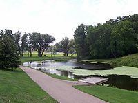 | ||
Fishing along the manitowoc river at manitou park
The Manitowoc River is a 35.8-mile-long (57.6 km) river in eastern Wisconsin in the United States. It flows into Lake Michigan at the city of Manitowoc.
Contents
- Fishing along the manitowoc river at manitou park
- Map of Manitowoc River Wisconsin USA
- CourseEdit
- Little Manitowoc RiverEdit
- References
Map of Manitowoc River, Wisconsin, USA
CourseEdit
The Manitowoc River is formed in eastern Calumet County by its north and south branches:
From the confluence of its forks, the Manitowoc flows generally eastwardly through central Manitowoc County to its mouth at Lake Michigan in the city of Manitowoc. Its largest tributary is the Branch River.
Little Manitowoc RiverEdit
The Little Manitowoc River is a 10.6-mile-long (17.1 km) stream that flows into Lake Michigan about 1 mi (2 km) north of the mouth of the Manitowoc River.
References
Manitowoc River Wikipedia(Text) CC BY-SA