
PIN 627421 Population 12,290 (2001) | Time zone IST (UTC+5:30) Local time Monday 10:47 AM | |
 | ||
Weather 32°C, Wind W at 11 km/h, 64% Humidity | ||
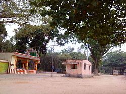
Manimutharu is a panchayat town in Tirunelveli district in the Indian state of Tamil Nadu.
Contents
Map of Manimutharu, Tamil Nadu
Demographics
According to the 2001 Indian census, Manimutharu had a population of 50,000. The female/male ratio was 2:1. Manimutharu had an average literacy rate of 74%, higher than the national average of 59.5%. The literacy rate was equal between males and females. In Manimutharu, 11% of the population was under 6 years of age.
Manjolai Hills
With elevations ranging from 1,020–1,500 metres (3,350–4,920 ft), the Manjolai area is set deep in the Western Ghats within the Kalakkad Mundanthurai Tiger Reserve in Tirunelveli District. Located on top of the Manimuthar Dam and the Manimuthar waterfalls, the Manjolai area comprises tea plantations and small settlements around them, Upper Kodaiyar Dam and a windy viewpoint called Kuthiravetti.
The tea plantations and the whole of Manjolai estates are operated by the Bombay Burmah Trading Corporation on forest lands leased from the government of Tamil Nadu. The three tea estates within the Manjolai area are Manjolai Estate, Manimutharu Estate and Oothu Estate. The estates are at elevations between 2300 feet and 4200 feet.