
Country United States County Dickinson Time zone CST (UTC-6) Elevation 393 m Zip code 67410 Local time Sunday 4:07 PM | Platted 1887 FIPS code 20-44225 Area 65 ha Population 98 (2013) Area code 785 | |
 | ||
Weather 32°C, Wind S at 39 km/h, 30% Humidity | ||
Manchester is a city in Dickinson County, Kansas, United States. As of the 2010 census, the city population was 95.
Contents
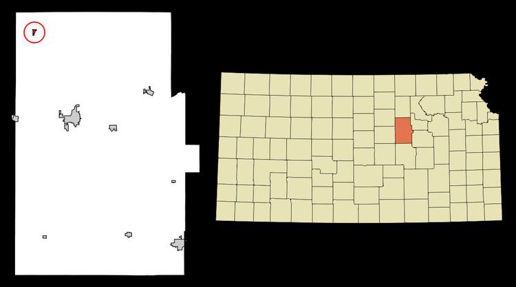
Map of Manchester, KS 67410, USA
History
In 1887, Atchison, Topeka and Santa Fe Railway built a branch line from Neva (3 miles west of Strong City) through Manchester to Superior, Nebraska. In 1996, the Atchison, Topeka and Santa Fe Railway merged with Burlington Northern Railroad and renamed to the current BNSF Railway. Most locals still refer to this railroad as the "Santa Fe".
Manchester was originally called Keystone, and under the latter name laid out in 1887. The name Manchester was adopted by 1890.
The post office in Manchester was discontinued in 1993.
Geography
Manchester is located at 39°5′37″N 97°19′17″W (39.093657, -97.321501). According to the United States Census Bureau, the city has a total area of 0.25 square miles (0.65 km2), all of it land.
2010 census
As of the census of 2010, there were 95 people, 38 households, and 24 families residing in the city. The population density was 380.0 inhabitants per square mile (146.7/km2). There were 60 housing units at an average density of 240.0 per square mile (92.7/km2). The racial makeup of the city was 92.6% White, 4.2% Native American, 1.1% from other races, and 2.1% from two or more races. Hispanic or Latino of any race were 1.1% of the population.
There were 38 households of which 34.2% had children under the age of 18 living with them, 36.8% were married couples living together, 18.4% had a female householder with no husband present, 7.9% had a male householder with no wife present, and 36.8% were non-families. 31.6% of all households were made up of individuals and 7.9% had someone living alone who was 65 years of age or older. The average household size was 2.50 and the average family size was 3.21.
The median age in the city was 35.9 years. 31.6% of residents were under the age of 18; 3.1% were between the ages of 18 and 24; 26.4% were from 25 to 44; 30.5% were from 45 to 64; and 8.4% were 65 years of age or older. The gender makeup of the city was 54.7% male and 45.3% female.
2000 census
As of the census of 2000, there were 102 people, 46 households, and 31 families residing in the city. The population density was 398.7 people per square mile (151.5/km²). There were 52 housing units at an average density of 203.3 per square mile (77.2/km²). The racial makeup of the city was 91.18% White, 0.98% African American, 0.98% Native American, 0.98% from other races, and 5.88% from two or more races. Hispanic or Latino of any race were 0.98% of the population.
There were 46 households out of which 23.9% had children under the age of 18 living with them, 56.5% were married couples living together, 8.7% had a female householder with no husband present, and 32.6% were non-families. 26.1% of all households were made up of individuals and 13.0% had someone living alone who was 65 years of age or older. The average household size was 2.22 and the average family size was 2.55.
In the city, the population was spread out with 19.6% under the age of 18, 3.9% from 18 to 24, 29.4% from 25 to 44, 29.4% from 45 to 64, and 17.6% who were 65 years of age or older. The median age was 41 years. For every 100 females there were 121.7 males. For every 100 females age 18 and over, there were 121.6 males.
The median income for a household in the city was $31,563, and the median income for a family was $32,500. Males had a median income of $22,500 versus $16,500 for females. The per capita income for the city was $14,035. There were 6.3% of families and 7.8% of the population living below the poverty line, including 12.0% of under eighteens and none of those over 64.
Education
Manchester is a part of USD 473 Chapman. The Chapman High School mascot is Chapman Fighting Irish.