
 | ||
Similar Te Apiti Wind Farm, Ruahine Range, Manawatu Gorge Entrance, New Zealand Rugby M, Te Manawa | ||
R580 southbound manawatu gorge new zealand
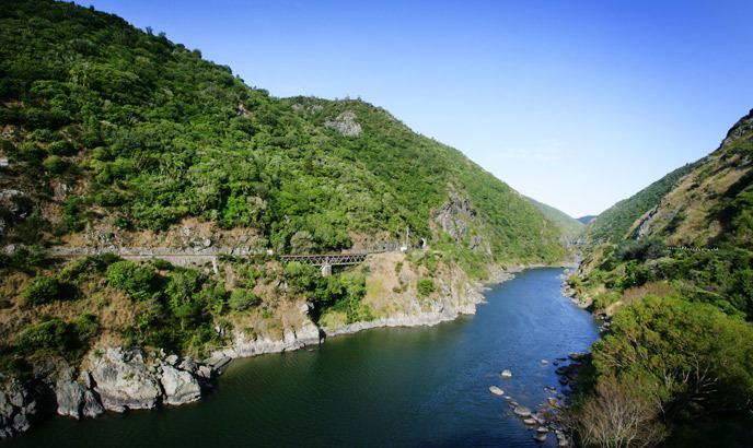
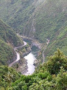
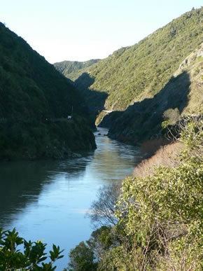
The Manawatu Gorge (in Māori Te Apiti, meaning "The Narrow Passage") runs for 6-9 km between the Ruahine and Tararua Ranges in the south part of the North Island of New Zealand, linking the Manawatu and Hawke's Bay regions. It lies to the northeast of Palmerston North. Its western end is near the small town of Ashhurst, its eastern end is close to the town of Woodville.
Contents
- R580 southbound manawatu gorge new zealand
- Manawatu gorge new zealand
- Geography
- Transport
- Manawatu Gorge Track
- References
Manawatu gorge new zealand
Geography
The Manawatu Gorge is significant because, unlike most gorges, the Manawatu River is a water gap, that is it runs directly through the surrounding ranges from one side to the other. This was caused by the ranges moving upwards at the same time as the gorge was eroded by the river, instead of the more usual erosion of an already existing range.
The Manawatu River is the only river in New Zealand that starts its journey on one side of the main divide and finishes it on the other side.
Transport
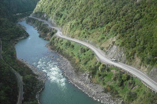
The road through the Manawatu Gorge, State Highway 3, is on the south side of the river, and was completed in 1872. It is the primary link between the two sides of the lower North Island. Other than Saddle Road and the Pahitatua Track, both narrow windy local roads a few kilometers north and south of the Manawatu Gorge, the gorge is the only east-west road connection between the Akatarawa Valley, 100 kilometres (62 mi) to the south, and SH5 between Taupo and Napier 150 kilometres (93 mi) north of the Manawatu Gorge.
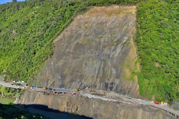
The road through the Manawatu Gorge has a history of sometimes being closed by slips, especially following inclement weather.
A single track rail connection was established on the northern side of the gorge; it was completed in 1891 and is now part of the Palmerston North – Gisborne Line. The rail connection is mainly used by goods trains; there are currently no scheduled passenger rail services through the gorge. Occasional railway excursions, typically with steam trains, also make use of the scenic Manawatu Gorge Railway line with its two tunnels and several small bridges.
The Old Gorge Cemetery lies on the north side of the Manawatu Gorge. Public access is available, but the cemetery was closed many years ago to further burials. The road is located just a few kilometres out of Woodville on the north side of the gorge.
In 2011 the gorge was closed after several massive landslips. It did not reopen until August 2012, and parts of the highway were still limited to one lane. In October 2012 it was temporarily closed so contractors could destroy large rocks that posed a threat to traffic. Restoration completed in November 2012.
SH3 was blocked again for one month by further slips after severe weather on 9 April 2015.
Manawatu Gorge Track
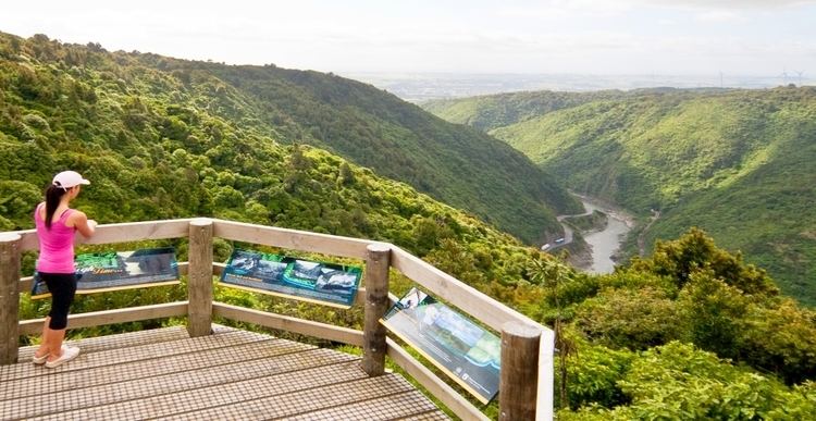
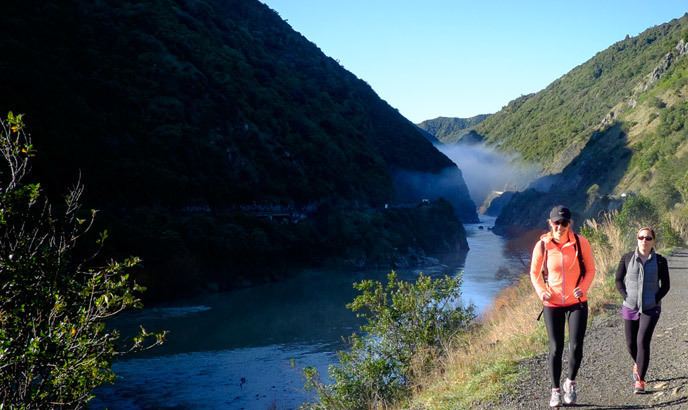
A 10 kilometres (6.2 mi) tramping track, the Manawatu Gorge Track, runs parallel to the gorge on the south side through native bush.
The walking track passes several lookout points, one of which is above the site of the 2015 landslide, aptly called the "Big Slip Lookout". The majority of the track leads through native bush, with the lookouts offering views overlooking the gorge and towards the Te Apiti Wind Farm continuing on the hills north of the gorge.
Also along the track, in the midst of native bush, stands the 6 metres (20 ft) tall metal sculpture of Whatonga, one of three recognised Māori chiefs on board the Kurahaupo Waka, which journeyed across the ocean to New Zealand. The statue was funded by the Manawatu Gorge Biodiversity stakeholder group and is made of steel. It was lowered to its location in the bush by helicopter, and blessed at a dawn ceremony on 11 April 2014. The artwork on the sculpture features hammer head shark patterns and depicts elements of the story of Whatonga's sea voyage as well as emblems of all of the Manawatu Gorge biodiversity project stakeholders.