
Highest point Manastash Peak | ||
 | ||
Mountains Mount Clifty, Manastash Peak, Quartz Mountain, Lookout Mountain | ||
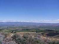
Manastash Ridge is a long anticline mountain ridge located in central Washington state in the United States. Manastash Ridge runs mostly west-to-east in Kittitas and Yakima counties, for approximately 50 miles. The ridge is part of the Yakima Fold Belt of east-tending long ridges formed by the folding of Miocene Columbia River basalt flows.
Map of Manastash Ridge, Washington 98926, USA
The highest point in Manastash Ridge is Manastash Peak at 6,335 feet (1,931 m), located 22.4 miles (36.0 km) west of Ellensburg, Washington. Interstate 82 crosses through the eastern portion of the ridge; the Manastash Ridge Summit is located at milepost 7 of the interstate (south of Ellensburg) or about 24 miles (39 km) north of Yakima, Washington at an elevation of 2,672 feet (814 m).
In addition to Manastash Peak, Manastash Ridge includes the peaks of Quartz Mountain (6,289 feet (1,917 m)), Mount Clifty (6,243 feet (1,903 m)), and Lookout Mountain (6,188 feet (1,886 m)). The astronomy department of the University of Washington maintains the Manastash Ridge Observatory, located about 9 miles (14 km) west-southwest of Ellensburg.