
Elevation 270 m | ||
 | ||
Traversed by Interstate 66Virginia State Highway 55 Similar Ashby Gap, Snickers Gap, Blue Ridge Mountains, Bull Run Mountains, Beverley Mill | ||
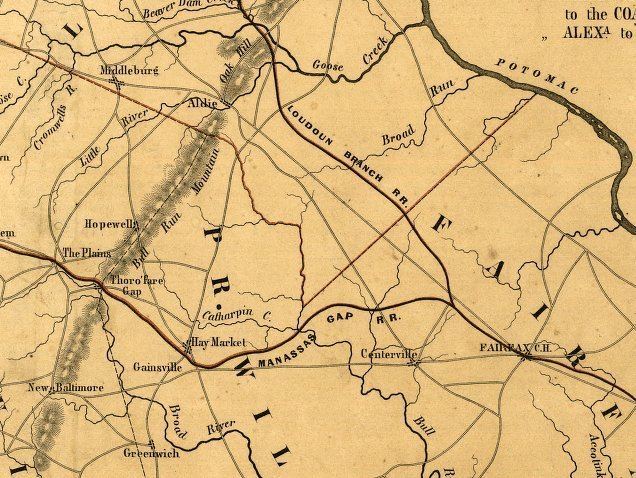
Manassas Gap is a wind gap of the Blue Ridge Mountains on the border of Fauquier County and Prince William County in Virginia. At an elevation of 887 feet above sea level, it is the lowest crossing of the Blue Ridge Mountains in the state.
Map of Manassas Gap, Marshall, VA 22642, USA
The Manassas Gap Railroad was completed through this pass in 1854, and today, the tracks form a part of the Norfolk Southern rail system. VA Route 55 and Interstate 66 also pass through Manassas Gap. In addition the north-south Appalachian Trail crosses the gap as well.
Virginia's independent cities of Manassas and Manassas Park derived their names from the railroad which was built through Manassas Gap.
References
Manassas Gap Wikipedia(Text) CC BY-SA