
Country Philippines Time zone PST (UTC+8) Area 112.9 km² Local time Monday 3:11 AM Province Negros Occidental | Barangays ZIP code 6120 Population 52,687 (2010) Area code 34 Dialling code 34 | |
 | ||
Region Negros Island Region (NIR) Congr. district 2nd district of Negros Occidental Weather 24°C, Wind NE at 11 km/h, 88% Humidity | ||
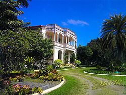
Victorias city silay city and manapla negros occidental
Manapla is a second class municipality in the province of Negros Occidental, Philippines. According to the 2010 census, it has a population of 52,687 people.
Contents
- Victorias city silay city and manapla negros occidental
- Map of Manapla Negros Occidental Philippines
- Discover negros municipality of manapla and victorias city
- Barangays
- References
Map of Manapla, Negros Occidental, Philippines
Discover negros municipality of manapla and victorias city
Barangays
Manapla is politically subdivided into 12 barangays.
References
Manapla Wikipedia(Text) CC BY-SA