
Elevation 2,419 m | Area 9,389 km² | |
 | ||
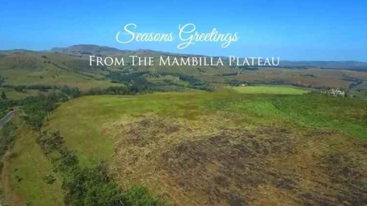
Travel guide living 2 000ft above sea level in mambilla plateau
The Mambilla Plateau is a plateau in the Taraba State of Nigeria. The plateau is Nigeria's northern continuation of the Bamenda Highlands of Cameroon.
Contents
- Travel guide living 2 000ft above sea level in mambilla plateau
- Seasons greetings from the mambilla plateau
- Location
- Climate
- Rainfall
- Topography
- Drainage
- Vegetation
- Towns
- People
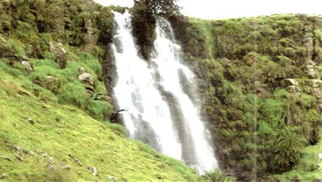
- Attractions
- References
The Mambilla Plateau has an average elevation of about 1,600 metres (5,249 ft) above sea level, making it the highest plateau in Nigeria. Some of its villages are situated on hills that must be at least 1,828 metres (5,997 ft) high above sea level.
Some mountains on the plateau and around it are over 2,000 metres (6,562 ft) high, like the Chappal Waddi (more appropriate name: Gang) mountain which has an average height of about 2,419 metres (7,936 ft) above sea level. It is the highest mountain in Nigeria and the highest mountain in West Africa if Cameroon's mountains, such as Mount Cameroon, are excluded.
The plateau developed on basement complex rocks.Tertiary basalts also occur on the Mambilla plateau and are mostly formed by trachytic lavas and extensive basalts, occurring around Nguroje. The Mambilla Plateau measures about 96 km (60 mi) along its curved length; it is 40 km (25 mi) wide and is bounded by an escarpment that is about 900 m (2,953 ft) high in some places. The plateau covers an area of over 9,389 square kilometres (3,625 sq mi). Gang ('Chappal Waddi') Mountain is found at the northeastern flank of the Plateau.
Seasons greetings from the mambilla plateau
Location
The Mambilla Plateau, cradle of the Bantu-speaking peoples (Zeitlyn & Connell, 2003; Griffith, 2007; Martin, 2009),and continuously inhabited for over four millennia by the same Mambillobantu culture, is found in the southeastern part of Taraba State of Nigeria under Sardauna local government area (the former Mambilla District set up in January 1940, which became known as 'Mambilla Local Authority' in 1970, and then as 'Mambilla Local Government Area' in 1981) . The current 'Sardauna' title is believed to be an inappropriate cognomen for this historically famous spot in Africa, given that the combination of three local government areas in one, which was the tenuous basis for the appellation, has since ceased to exist. The false premise of a "sardauna" "discovering" the area is untenable, since the entire former Northern Cameroon Province headquartered at Mubi has since reverted to the use of their various true names. The people of the Mambilla Plateau are equally entitled to their ancient and historical identity and to be appropriately named, just as all other areas in the defunct "Sardauna" Province. The name "Mambilla" is a derivative of the ancient name "Mamberre" which has been used for the Mambilla Plateau from ancient times and which concomitantly denotes its inhabitants.
The plateau has its south and eastern escarpments standing along the Cameroonian border, while the remainder of its giant northern escarpment and its western slope are in Nigeria.
Climate
The climate of the plateau is comparatively cold. Daytime temperatures hardly ever exceeds 25 °C (77.0 °F) making it the coolest region in Nigeria. Strong winds prevail during the daytime, and the rainy season lasts from mid-March until the end of November. As a result of its high elevation, the plateau experiences temperate weather conditions but on a smaller scale due to its location in a tropical environment.
Rainfall
The rainy season on the Mambilla Plateau is associated with frequent and heavy rainfall due to orographic activities on the plateau involving moist winds from the south Atlantic Ocean in southern Nigeria and the steep edges and escarpments of the plateau.The Mambilla Plateau receives over 1850 millimetres of rainfall annually. It is also Mosquito and Tse-Tse fly free.
Topography
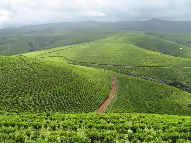
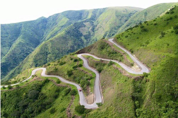
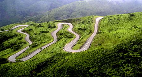
The Mambilla Plateau is hilly with deep gorges and travelers are constantly passing from one panoramic view to the other. The plateau is entirely covered by soil with occasional occurrence of granite.
Drainage
The plateau is dissected by many streams and rivers; notably among them are the Donga River and Taraba River, with both having their sources on/from the Mambilla Plateau.
Vegetation
Vegetation on the plateau comprises low grasses with trees being noticeably absent except for man-made forest planted by German colonialist during the period of German administration of the cameroons (c. 1906-1915)and other Nigerian government tree planting programs. The plateau is the only region of Nigeria that grows the tea plant on a large scale, and there are several tea farms, although the sector remains mostly underdeveloped. It is also home to the Gashaka Gumti National Park, which is the largest national park and protected area in all of Nigeria, as well as the Ngel Nyaki Forest Reserve, both of which harbor rare and endangered West/Central African plant and animal species endemic to the area. The eucalyptus tree is the dominant tree is these man made forest as a result of the easily adaptability of the eucalyptus tree to the harsh climatic conditions on the plateau. The abundance of low lush green grasses on the plateau has attracted a large number of cattle,whose advent beginning during British rule affected the plateau's vegetation. This has resulted in overgrazing of the plateau and has created problems between the cattle herders, referred to as the fulanis, and the indigenous people, the Mambila.
Towns
The Mambilla Plateau constitutes one of Taraba State's largest local government areas. There are numerous towns on the plateau with populations ranging from 2,000 to 20,000 people except for Bommi (Gembu), Nigeria|Gembu]]), which is a sprawling ancient Mambilla city with a much higher population. The latter contains the headquarters of new-christened "Sardauna" Local Government Area which is synonymous with the Mambilla Plateau. Other important towns on the plateau are Liimil (Mbamga), Mvurr (Warwar), Bang, Mbuk (Tapnyia), Ndik (Kabri), Gam (Vakude), Mbar, Kara, Mang, Dembe, Nge (Leme), Mbun (Kakara) (Which is home to Mambilla Beverages Company Ltd, the only Tea Production Company in West Africa), Furu (Yerrmaru), Yirrum, Ngumbun, Kuma, Kerke (Titong), Mbungnu (Nguroje), New Ndaga (Mayo Ndaga), Benene (Maisamari), and Mamal (Hainare). According to Percival (1938), the Germans met some 200 villages on the Mambilla Plateau,all being of Mambilla origin then.
Today, there are, besides the Mambilla towns and villages, Kaka-Yamba settlements in the southwest along the Cameroonian border which are believed to be of recent emergence (Connell, 1997; Hurault, 1998; SIL ethnologue,2010) and include Anterre and Inkirri established by splinter groups from Mfumte area of Cameroon's North-West Region, both being place names still in use in Mfumte area. Others are Ndum, Warrkaka, and their satellites emanating from the Donga-Mantung Division of the same Region of Cameroon Republic.
People
The major ethnic groups on the plateau, include, the Mambila (the ancient population of these mountains), Kaka, Fulani, trading communities of Igbo, Wimbum (Kambu) and Banso, with the Mambilla being the majority and original inhabitants. The major Language spoken on the Mambilla Plateau are Mambilla (the language of the predominant population), Fufulde (used for Commercial transactions by various groups), Kaka, Hausa, Igbo, etc. Note, however, that only the Mambilla and Kaka have existing villages while the Fulanis established (British times) cattle-farm settlements nestling between the villages.