
Country New Zealand Ward West Population 726 (2006) | Region Bay of Plenty Local time Monday 3:14 AM | |
 | ||
Local Authority Weather 11°C, Wind W at 6 km/h, 90% Humidity | ||
Mamaku is a small town in the Bay of Plenty Region of the North Island of New Zealand. It lies on the Mamaku Plateau at an elevation of 560 metres (1,840 ft) above sea level. Situated at the highest point of the now-mothballed Rotorua Branch railway line, the town is 4 kilometres (2.5 mi) south of State Highway 5. As of the 2006 census, the normally-resident population of Mamaku was 726, of whom 37.4% identified their ethnicity as Māori.
Contents
Map of Mamaku, New Zealand
History
Mamaku was originally called Kaponga, but the name was changed to Mamaku in 1890 to avoid confusion with the town of Kaponga in Taranaki. Ironically, the plant known as Mamaku, the Black tree fern, is not found in the area. European settlement commenced in the 1880s, and for a time Mamaku rivalled Rotorua for size.
The main industry in Mamaku was originally native timber logging. In the late 19th century and early 20th century Mamaku had, at one time, 5 timber mills, all logging native timber from the surrounding bush. This reduced over time and today there are no timber mills operating in the village.
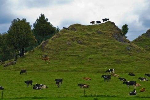
Another major industry established in Mamaku was farming, primarily milk and sheep. This continues today as perhaps the main source of income for the village.
Mamaku School, the first and only school in the village, was opened in 1895 to offer education to students for the first 8 years of school. NOTE: New Zealand provides schooling up to 13 educational years.