
Population 851 (2011 census) Time zone AEST (UTC+10) Area 2.7 km² Local time Sunday 7:36 PM | Postcode(s) 2319 Elevation 3 m Postal code 2319 | |
 | ||
Location 192 km (119 mi) NNE of Sydney45 km (28 mi) NNE of Newcastle30 km (19 mi) ENE of Raymond Terrace Weather 24°C, Wind NE at 19 km/h, 87% Humidity | ||
Mallabula is a primarily residential suburb of the Port Stephens local government area in the Hunter Region of New South Wales, Australia. It is located on the Tilligerry Peninsula between Lemon Tree Passage and Tanilba Bay. The origin of the name may mean "three swamps" in the local Aboriginal language.
Contents
Map of Mallabula NSW 2319, Australia
Geography
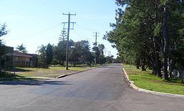
Mallabula is a low-lying suburb, almost at sea level.Note3 It is bisected by Lemon Tree Passage Road, which stretches for the full length of the peninsula, from Salt Ash in the south-west, to Lemon Tree Passage. In the northern part of the suburb is a small subdivision covering 0.5 square kilometres (0.2 sq mi) on the banks of Tanilba Bay.
The beach consists mainly of sand flats that are exposed at low tide and almost completely covered at high tide preventing the beach from being useful as either a swimming or surfing beach. Near Rookes Point, at the mouth of Tanilba Bay, the land rises to a height of 9.1 metres (30 ft) AMSL. At the eastern extremity of this area the land reaches a peak of 18.3 m (60 ft) in a heavily forested area. However, between these two points and throughout the remainder of the suburb the land is generally no more than 3 m (10 ft) AMSL and is predominantly sandy.
The land south of Lemon Tree Passage Road is generally uninhabited, occupied only by a handful of homes in a single cul-de-sac and a sewage treatment plant.
Demographics
At the 2011 census Mallabula had a population of 851. Almost all of the population resides in a small, residential subdivision occupying only 18.5% of the entire suburb. The population density in this area is 1,702/km2 (4,410/sq mi). The remaining population resides in four homes in a single cul-de-sac south of Tanilba Bay and is accounted for in the ABS population data for that suburb.