
PIN 764 xxx Area 5,791 km² Literacy 49.5% | Time zone IST (UTC+5:30) Vehicle registration OD-10 Elevation 195 m Population 612,727 (2011) | |
 | ||
Malkangiri district(Odia: ମାଲକାନଗିରି ଜିଲ୍ଲା)is a district of the state of Odisha, India.
Contents
- Map of Malkangiri Odisha
- Heavy rains lash odisha s malkangiri district
- History
- Geography
- Economy
- Demographics
- Transport
- Vidhan sabha constituencies
- References
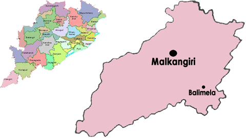
Map of Malkangiri, Odisha
Heavy rains lash odisha s malkangiri district
History
This district was carved out as district from the undivided Koraput district on 2nd Oct, 1992. The administrative headquarters of this district is Malkangiri town.
Malkangiri is the new home of the Bangladeshi refugees, who were rehabilitated since 1965 under the Dandakaranya Project. Also some Sri Lankan Tamil refugees were rehabilitated in Malkangiri town, following the armed struggle of LTTE in the early 90's (most of them have returned, baring a couple of house holds). Currently it is one of the most naxalite-affected areas of the state.
Geography
Some of the most beautiful locations are, the back waters of Balimela Dam, Satiguda Dam, Bonda Ghati (abode of the Bonda people, a prolific tribe listed amongst the Particularly Vulnerable tribal Groups of India).
Economy
This district has a Power Station at Balimela and the proposed Vijaywada-Ranchi corridor road will pass through it.
In 2006 the Ministry of Panchayati Raj named Malkangiri one of the country's 250 most backward districts (out of a total of 640). It is one of the 19 districts in Odisha currently receiving funds from the Backward Regions Grant Fund Programme (BRGF).
Demographics
According to the 2011 census Malkangiri district has a population of 612,727, roughly equal to the nation of Solomon Islands or the US state of Vermont. This gives it a ranking of 523rd in India (out of a total of 640). The district has a population density of 106 inhabitants per square kilometre (270/sq mi) . Its population growth rate over the decade 2001-2011 was 21.53%. Malkangiri has a sex ratio of 1016 females for every 1000 males, and a literacy rate of 49.49%.
Transport
Malkangiri district is a very remote part of Odisha. It is connected through Jeypore-Motu Highway and Govindpalli-Sileru Road. By rail Network, Malkangiri is not connected at all. Nearest Major Railway Stations are Koraput Railway Station, Jeypore, and Jagdalpur. Nearest airport at Vishakhapatnam- 322 km. via Koraput, Sunki, Vijayanagaram. Distance from other towns(from Malkangiri town)-
railway stations - 01 ; RTC depoits - 02
Vidhan sabha constituencies
The following is the 2 Vidhan sabha constituencies of Malkangiri district and the elected members of that area