
Airport type Public Location St. Simons Island Website [1] Code SSI Phone +1 912-638-8617 | Serves Brunswick, Georgia Elevation AMSL 19 ft / 6 m 4/22 5,800 Elevation 6 m Owner Glynn County, Georgia | |
 | ||
Address 1759 Demere Rd, Saint Simons Island, GA 31522, USA | ||
Malcolm mckinnon airport saint simons island ga
Malcolm McKinnon Airport (IATA: SSI, ICAO: KSSI, FAA LID: SSI) is a county-owned public-use airport located five miles (8 km) east of the central business district of Brunswick, a city in Glynn County, Georgia, United States.
Contents
- Malcolm mckinnon airport saint simons island ga
- Flight from jekyll island to malcolm mckinnon airport
- Facilities and aircraft
- References
Located on St. Simons Island, it is also known McKinnon St. Simons Island Airport. It was named for Malcom B. McKinnon, chairman of the County Commission when construction started in 1935. The airport opened on May 28, 1938, seven months after his death. During World War II, it operated as Naval Air Station St. Simons Island and was eventually home to the Navy Radar Training School. Although NAS St. Simons Island remained an active air station following the war, its activities were eventually merged into nearby NAS Glynco and by 1947 it was finally closed as a naval air station and returned to its current use as a civilian airport.
The airport lies on the site of Mulberry Grove plantation, which was owned by the Demeré family from the 1750s until the Civil War.
Flight from jekyll island to malcolm mckinnon airport
Facilities and aircraft
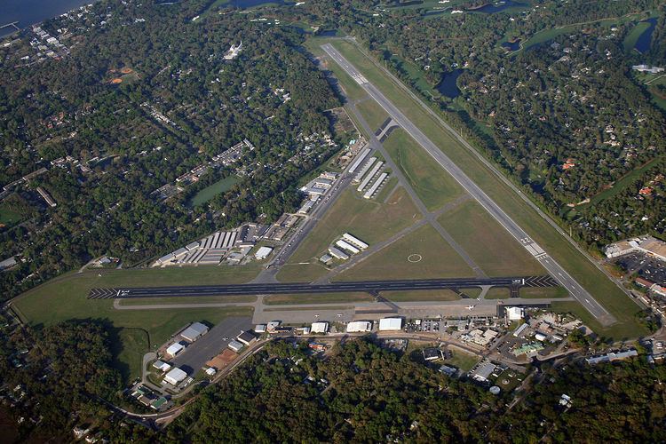
Malcolm McKinnon Airport covers an area of 320 acres (130 ha) which contains two asphalt paved runways: 4/22 measuring 5,800 x 100 ft (1,768 x 30 m) and 16/34 measuring 3,313 x 75 ft (1,010 x 23 m). For the 12-month period ending August 7, 2007, the airport had 47,750 aircraft operations, an average of 130 per day: 98% general aviation and 2% military.