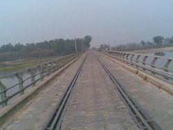
District Ferozepur Named for Gurpreet Virk. Elevation 201 m Area code 01682 | Founded by Gurpreet virk Elevation1000 201 m (659 ft) Area 6 km² Local time Sunday 2:19 AM | |
 | ||
Weather 17°C, Wind NE at 5 km/h, 70% Humidity | ||
Makhu (Punjabi: ਮਖੂ) is a town and a nagar panchayat in Ferozepur district in the Indian state of Punjab.
Contents
- Map of Makhu Punjab 142044
- Geography
- Demographics
- How to reach
- Hospitals Medical Stores Offices
- References
Map of Makhu, Punjab 142044
Geography
Makhu has an average elevation of 201 metres (659 feet).
Demographics
As of 2001 India census, Makhu had a population of 12,173. Males constitute 52% of the population and females 48%. Makhu has an average literacy rate of 61%, higher than the national average of 59.5%: male literacy is 65%, and female literacy is 56%. In Makhu, 14% of the population is under 6 years of age. Makhu is situated on Amritsar Bathinda national highway. It is 5 km away from Harike Sanctuary, well known place, where Satluj and Beas river mingle together. Many Doctors are available in this small town.
How to reach
By Air: Makhu is located 63 km from Amritsar airport (Sri Guru Ram Das Ji International Airport) By Rail: Makhu has its own railway station. By Road: Makhu town is located near to “Amritsar-Faridkot road on NH 15, and SH 19.
