
Country Vietnam Capital Mai Châu Area 520 km² Population 48,570 (2003) | Region Northwest Time zone UTC + 7 (UTC+7) Province Hòa Bình Province Local time Saturday 4:55 PM | |
 | ||
Points of interest Chieu Cave, Thác Gò Lào, Cột Cờ Mai Châu | ||
My new favorite place in vietnam mai chau travel
Mai Châu is a rural district of Hòa Bình Province in the Northwest region of Vietnam. The district is located at about 160 km from Ha Noi. The scenery of Mai Châu attracts many tourists..
Contents
- My new favorite place in vietnam mai chau travel
- Map of Mai ChC3A2u District Hoa Binh Vietnam
- Geographical features
- Cultural overview
- Architecture
- Environmental pressures
- References
Map of Mai Ch%C3%A2u District, Hoa Binh, Vietnam
In 2003 the district had a population of 48,570. The district covers an area of 520 km². The district capital is the city of Mai Châu.
Geographical features
Mai Châu is a mountainous region located in Hòa Bình Province, approximately 135 km from Hanoi and 65 km from Hòa Bình.
Cultural overview
The Ban Lac People have Thai ancestors that settled in the North-Western area of Vietnam. The two tribes, White Thai and Black Thai, settled in the same area and make up the largest ethnic population of the region.
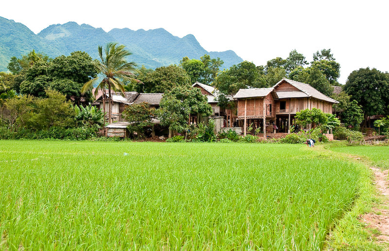
Architecture
The Mai Châu area is well known for its stilt houses. The type of stilt houses, or pile dwellings, they construct are called Thai stilt houses and are made of bamboo and timber. These houses are elevated 10–12 feet off the ground in order to avoid water damage and shelter animals from the elements.
Environmental pressures
Mai Châu faces several environmental concerns;