
 | ||
Similar Great Smoky Mountains, Shenango River Lake, Great Smoky Mountain, Sesame Place, Conneaut Lake Park | ||
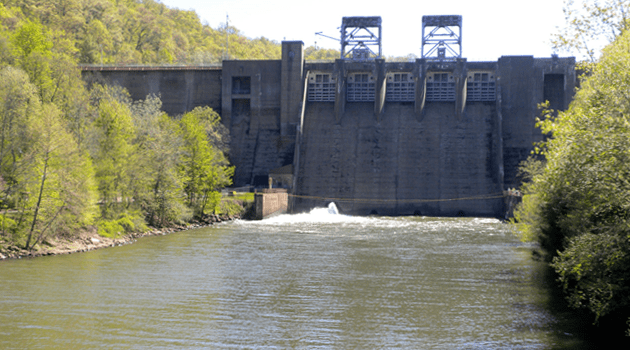
Mahoning Creek Dam is a dam in Armstrong County, Pennsylvania.
Map of Mahoning Creek Dam, Dayton, PA 16222, USA
The concrete gravity dam was constructed in 1941 by the United States Army Corps of Engineers, with a height of 162 feet, and a length of 926 feet at its crest. It impounds Mahoning Creek, a tributary of the Allegheny River, primarily for flood control. It's one of sixteen flood control projects in the area. The dam is owned and operated by the Pittsburgh District, Great Lakes and Ohio River Division, Army Corps of Engineers.
In 2012 the dam is being retrofitted for hydroelectric power generation expected to produce 6 MW.
The riverine reservoir it creates, Mahoning Creek Lake, has a normal water surface of 280 acres (110 ha), a maximum capacity of 94,000 acre feet (116,000,000 m3), and a normal capacity of 9,550 acre feet (11,780,000 m3). Recreation includes boating, fishing, camping, hiking, and the facilities of the state-run Mahoning Creek Lake Park. It is located between Redbank Township and Wayne Township in Armstrong County.