
Country United States Area 11.81 km² Population 6,134 (2000) | Territory Puerto Rico Local time Saturday 12:00 AM Municipality Ponce | |
 | ||
Weather 22°C, Wind NE at 8 km/h, 84% Humidity | ||
Magueyes (Barrio Magueyes) is one of the 31 barrios of the municipality of Ponce, Puerto Rico. Together with Cerrillos, Machuelo Arriba, Maragüez, Montes Llanos, Portugues, Sabanetas, and Tibes, Magueyes is one of the municipality's eight interior barrios. The name of this barrio is of native Indian origin. It was created in 1831.
Contents
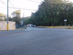
Map of Magueyes, Ponce, Puerto Rico
History
Magueyes is one of the oldest barrios in Ponce. It is home to Hacienda Buena Vista, dating from 1833. The word Magueyes is the plural form of the word Maguey which is a word of Taino origin.
Boundaries
Magueyes is bounded on the North by the hills north of Tierras Buenas Road and the hills south of Las Lomas Road, on the South by Ruth Fernandez Boulevard, on the West by the hills west of PR-123, and on the East by the hills east of PR-123 and by Ruth Fernandez Boulevard.
In terms of barrio-to-barrio boundaries, Magueyes is bounded on the North by Guaraguao, on the South by Magueyes Urbano and Portugues Urbano, in the West by Marueño and Canas, and on the East by Tibes and Portugues.
Features and demographics
Magueyes has 4.56 square miles (12 km2)of land area and no water surface area. In 2000, the population of Magueyes was 6,134 persons, and it had a density of 1,345 persons per square mile. Magueyes is the ninth most populous barrio in the municipality.
Running all along the full length of Magueyes is Rio Canas, which effectively divides the barrio in two almost identically sized areas. The communities of Corral Viejo, Las Delicias, El Madrigal, Estancias de Country Club, Lomas de Country Club, Granada Hills, Reparto Lomas del Sol, Reparto El Valle, and (Parcelas) Magueyes proper are located in Magueyes.
The main road serving Barrio Magueyes is PR-123. PR-501 also makes a short appearance in the lower southwestern part of the barrio.
The highest point of barrio Magueyes stands at 2,066 feet and is located at the extreme northeast tip of the barrio.
Landmarks
Hacienda Buena Vista is located in Magueyes.