
 | ||
Maelor is amazing taichi panda heroes maelor review
Maelor is a border area of north-east Wales and north-west England, now entirely part of Wrexham County Borough.
Contents
Wtf maelor in pvp taichi panda heroes pvp
History
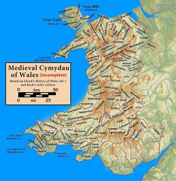
Maelor originated as a cantref of the Kingdom of Powys, focused on Bangor-on-Dee and containing of the commotes of Maelor, Iâl, Ystrad Alun and Yr Hob.
It became divided from the kingdom by the construction of Offa's Dyke in the eighth century and became part of the Kingdom of Mercia. It was reclaimed for Powys during the reign of Stephen of England (1135–54) by Madog ap Maredudd of Kingdom of Powys. He died in 1160 and the kingdom was subdivided amongst his heirs, Maelor becoming a substantial part of what was later known as Powys Fadog. By the thirteenth century Maelor had been divided into numerous parts including Maelor Gymraeg (English: Welsh Maelor) based upon Wrexham, and Maelor Saesneg (English: English Maelor) which included various Anglo-Norman lordships, namely Overton, Ellesmere, Whittington and Oswestry.
In 1282–1283, Edward I of England completed the conquest of the area east of the River Dee, the lordship being known as the Maelor Saesneg. The western area remained Welsh as the Maelor Gymraeg. These names existed by 1202.
English Maelor (Welsh: Maelor Saesneg)
The Maelor Saesneg is the area enclosed by the Welsh/English border where it bulged to the east almost to Whitchurch. In 1397, under Richard II of England, the Maelor Saesneg was merged with the County Palatine of Chester to form the Principality of Chester. In 1536 the area was included in the newly created county of Flintshire, forming the Hundred of Maelor. Although part of Flintshire, Maelor Hundred was an exclave, surrounded by Cheshire, Shropshire and Denbighshire. The administrative centre of the area, often referred to as Flintshire Detached, was Overton and it included the villages of Bangor on Dee, Bettisfield, Bronington, Hanmer, Knolton, Penley, Tybroughton, Willington and Worthenbury. An OS map specifically including the area, dating from 1905, is available from Old Ordnance Survey Maps (Sheet 122) entitled "Whitchurch, Nantwich and English Maelor".
In 1887 a Boundary Commission was appointed to review the boundaries of counties in England and Wales. At an inquiry at Overton, it was found that most of the population of the area favoured it becoming part of Shropshire, and this was later supported by resolution of the Flintshire justices of the peace. However, when local government legislation was introduced no change was made.
Under the Local Government Act 1894 the area became Overton Rural District which was again renamed in 1953 as Maelor Rural District, remaining as a detached part of Flintshire until 1974.
Maelor Gymraeg
The Maelor Gymraeg, the "Welsh-speaking Maelor", is an ancient district of Wales to the west of the River Dee. It corresponds approximately to the later parishes of Bersham, Erbistock, Marchwiel, Ruabon and Wrexham in the historic county of Denbighshire which was created in 1536.
The Maelor today
In 1974, local government in Wales was reorganised, and both halves of the Maelor were included in Wrexham Maelor, one of six districts in the new county of Clwyd. In 1996 a further local government reorganisation took place, and Maelor became part of the county borough of Wrexham.