
Elevation 675 m (2,215 ft) Local time Friday 12:41 PM | Prominence 675 m (2,215 ft) | |
 | ||
Weather 23°C, Wind NE at 55 km/h, 59% Humidity | ||
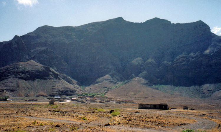
Madeiral or Monte Madeiral (Portuguese meaning "green mountain") is a mountain in the island of São Vicente, Cape Verde. Its elevation is 675 meters tall and is the second tallest on the island and top part is mainly lined west to east for some 500 to 600 meters. It gives its name to a small settlement belonging to Calhau, The mountaintop is just south of the settlement and is located in around a third of the way to the Atlantic Ocean. Numerous streams flows to the south and a few north to Calhau. The mountains forms a part of Monte Verde National Park (sometimes as Monte Verde e Madeiral),. the park area mainly does not include the valley portion of Calhau but parts or most of the mountain area.
Map of Madeiral, Cape Verde
It is an example of a sub-humid ecosystem. Of the 93 inventoried species of flora, 17 are on the list of endangered species of São Vicente. Examples of species that are not found elsewhere on the island are Limonium jovi-barba, Sonchus daltonii, Echium stenosiphon ssp. stenosiphon, Campanula jacobaea, Davallia canariensis and Kickxia elegans.
The geology forms a part of a rock formation known as Madeiral-Monte Cara formation with its length of 10 to 12 kilometers and rocks are deep as 2,500 meters. They were formed about 4.5 million years ago.
Panoramic views at the area of the upper parts includes much of the island except for its outer parts and most and the islands of Santa Luzia to the east and Santo Antão to the northwest.