
Type Street Length 2 km Major cities Hobart | Route number(s) A6 Region Hobart | |
 | ||
East end | ||
Video open home 137 139 macquarie street hobart
Macquarie Street a major one way street passing through the outskirts of the Hobart Central business district in Tasmania, Australia. Macquarie street is named after Lachlan Macquarie, who oversaw the planning of Hobart’s inner city grid layout. The street forms a One-way couplet with nearby Davey Street connecting traffic from the Southern Outlet in the south with traffic from the Tasman Highway to the east and the Brooker Highway to the north of the city. With annual average daily traffic of 28,500, the road is one of the busier streets in Hobart.
Contents
- Video open home 137 139 macquarie street hobart
- Map of Macquarie St Tasmania Australia
- Proposed bypass
- References
Map of Macquarie St, Tasmania, Australia
From the South Hobart intersection with Cascade Road, Washington Street and Darcy Street, Macquarie Street runs approximately 2 km (1.2 mi) east from the suburb of South Hobart as a two-way street until it reaches the intersection with the southern outlet where it becomes a one-way street for the duration of its length. It is primarily four lanes with the exception of its two-way section which is one lane both ways. The intersections on the one-way portion of the street are regulated by Synchronised traffic lights.
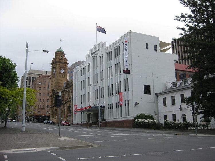
Macquarie Street borders the city garden Franklin Square. Prominent buildings in the street include the Hotel Grand Chancellor, the Lands Building, which houses the Department of Primary Industries, Water and Environment; the Mercury building; St Davids Cathedral; and the Reserve Bank Building.
Macquarie Street is featured as a property in the Australian version of Monopoly.
Proposed bypass
The current One-way couplet system between Macquarie Street and Davey Street was first proposed with the publication of the Hobart's Transportation study in 1965. At the time the couplet system was intended to be a stop gap measure before the then proposed Northside Freeway could be completed. However the proposed freeway was seen as controversial and abandoned. Since the completion of the couplet in 1987, there has been no alternative route between the Southern outlet and the other major arterial roads in Hobart. There has since been several design proposals for a tunnel under the city ranging from cut and cover proposals under Davey/Macquarie Streets to large scale bored tunnels running from the Southern Outlet through to the Tasman Bridge.