
Population 1,113 Civil parish GladsmuirPencaitland Sovereign state United Kingdom Local time Friday 6:38 AM | OS grid reference NT434723 Post town TRANENT Dialling code 01875 | |
 | ||
Weather 4°C, Wind SW at 26 km/h, 86% Humidity | ||
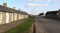
Macmerry (Gaelic: Magh Mhoire) is a large village located on the old A1 (now renumbered the A199) just east of Tranent.
Contents
Map of Macmerry, Tranent, UK
The village has a primary school with a roll of around 100.
There is an industrial estate to the east of the town. Originally this area was part of the Macmerry Aerodrome, also known as Penston, which closed in 1953.
There was a railway branch line until 1960 which served the local coal mines.
In 2009 a community based history project was launched by the Living Memory Association. The Macmerry Lives project collected memories of the school, pottery making, the aerodrome, mining industry and local farming.
Macmerry now boasts a range of facilities that have grown as the village has expanded, some of these include:
Many teams from around East Lothian often play at Macmerry football pitches, while the bowling club is often busy especially on Friday nights for the league matches.
Transport
Macmerry has two major bus networks First and Lothian Buses
First's 106/108/X6/X8 all serve the village town towards either Dunbar or Haddington
Lothian Buses service 104 which is owned by Lothian Country Buses serves the area and continue on towards Gladsmuir and then Haddington. Macmerry is in Zone C of Lothian Country Buses fare zone map, Alongside Gladsmuir, Ormiston and Pencaitland.