
Population 5,506 (2011 census) Postcode(s) 2615 Area 4.3 km² Postal code 2615 | Established 1972 Founded 1972 | |
 | ||
Macgregor is a residential suburb in the Belconnen district of Canberra, located within the Australian Capital Territory, Australia. It was gazetted on 9 September 1971. It lies next to the suburbs of Dunlop, Latham and Holt on the western side of Belconnen, with Florey Drive the boundary to the east, Ginninderra Drive on the north, and Southern Cross Drive on the south.
Contents
Map of MacGregor ACT 2615, Australia
The suburb of Macgregor is named after Sir William MacGregor, Governor of Queensland 1909–14 and first Chancellor of the University of Queensland, 1911. Streets are named after members of the Australian medical professions.
Facilities and location
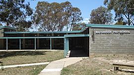
Macgregor has a primary school and neighbourhood oval. The main road in the suburb is Osburn Drive, which passes by a shop (formerly a petrol station) and an area that was formerly a small shopping centre – this has now been demolished and redeveloped into Kings swimming pool.
Macgregor is primarily situated on Mount Goodwin (612 metres (2,008 ft)). Ginninderra Creek runs through the middle of the suburb for 1.4 kilometres (0.87 mi).
Political representation
For the purposes of Australian federal elections for the House of Representatives, Macgregor is in the Fenner.
For the purposes of Australian Capital Territory elections for the ACT Legislative Assembly, Macgregor is in the Ginninderra electorate.
Geology
Silurian age Deakin Volcanics purple rhyodacite covers the suburb.