
Area 15.45 km² | Subregion Alto Trás-os-Montes Population 208 (2011) | |
 | ||
Intermunic. comm. | ||
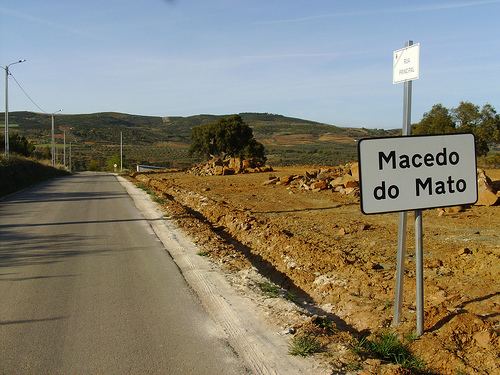
Macedo do Mato is a civil parish in the municipality (concelho) of Bragança, in northern Portugal. The population in 2011 was 208, in an area of 15.54 km².
Contents
Map of Macedo do Mato, Portugal
History
There are abundant archaeological vestiges in the parish. The oldest and populous fortification of the region, Cabeço da Terronha, dates from the Iron Age. Its settlement was assisted by the good natural conditions for defense and controlled a geo-strategic position in the region. Artifacts collected from the surface of the site included ceramic fragments.
A Roman funerary complex was located in Sanceriz, with the inscription: DOCIO SANIGII ANNO / RVM LX.
Arising between the Roman and prehistoric periods is the prehistoric rock art site at Fonte dos Engaranhados, situated on the southwest flank of the mountain that is now located the sanctuary of Senhora do Aviso. Included in the sites artifacts is a small schist stone with the small carvings of angular and semi-circles.
Sanceriz received a foral (charter), that was later renewed on 30 December 1284, from King Manuel of Portugal (sometime in the first quarter of the 15th century).
In the first half of the 19th century, during the Liberal Wars battles occurred between the Liberal and Absolutist. Miguelist forces were pursued until Coitada where, between Macedinho and Bagueixe, they were completely annihilated.
The municipality of Sanceriz was extinguished in 1836. From this point it was integrated into the municipality of Izeda, until 1855, where it was definitively annexed into the municipality of Bragança. Until this period Frieira was the town and seat of the municipal government.
Geography
The parish of Macedo do Mato is found in the extreme south of the municipality of Bragança. About 30 kilometres (19 mi) from the parish seat, along the limit with the municipality of Macedo de Cavaleiros, is the left margin of the Ribeiro de Vale de Moinhos. Macedo includes several settlements, including Macedo, Frieira and Sanceriz.