
Traditional Chinese 澳門半島 Hanyu Pinyin Jyutping Oumun bundou | Simplified Chinese 澳门半岛 IPA [ʔōu mǔːn pūːn tǒu] | |
 | ||
Similar Senado Square, Ruins of St Paul's, A‑Ma Temple, Historic Centre of Macau, Fortaleza do Monte | ||
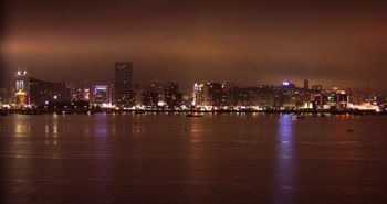
Macau Peninsula is the most populous and historic part of Macau. It has an area of 8.5 square kilometres (3.3 sq mi) (4 by 1.8 kilometres (2.5 mi × 1.1 mi)) and is geographically connected to Guangdong province, at the northeast, through an isthmus 200 metres (660 ft) wide. The peninsula, together with the city centre of Zhuhai, sits on an island separated from the continent by distributaries of the Pearl River. The Border Gate (Chinese: 關閘; Portuguese: Portas do Cerco) was built on the northern isthmus. At the south, the peninsula is connected to Taipa Island by three bridges, the Friendship Bridge (Ponte de Amizade); the Macau-Taipa Bridge (Ponte Governador Nobre de Carvalho); and the Sai Van Bridge (Ponte de Sai Van). The longest axis extends 4 kilometres (2.5 mi) from the Border Gate to the southwestern edge, Barra (媽閣嘴). There is a western Inner Harbour (內港), and an eastern Outer Harbour (外港). The 93 metres (305 ft) Guia Hill (松山) is the highest point on the peninsula, which is, on an average, 50 to 75 metres (164 to 246 ft). Many coastal places are reclaimed from sea. The Historic Centre of Macau, which is entirely in the Macau Peninsula, became a World Heritage Site in 2005.
Contents
Map of Macau Island, Macau
Freguesias
The peninsula corresponds to the historical Concelho de Macau, which is divided into five regions, nominally parishes, with no authority: