
Primary inflows | Primary outflows Shuswap River Max. length 35 km (22 mi) | |
 | ||
Surface area 5,990 ha (14,800 acres) | ||
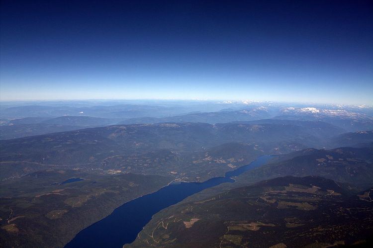
Mabel Lake is a lake located in southern Interior British Columbia, Canada, that is fed by and drained by the Shuswap River. It is located southeast of Shuswap Lake, northeast of Okanagan Lake, and west of the Monashee Mountains, and is popular for camping and fishing.
The lake is oriented roughly north to south, and is approximately 35 km long. The Shuswap River flows out of Sugar Lake into the southern end of Mabel Lake, and issues westward from the middle part of the lake into Mara Lake. Despite being part of the Shuswap Lake drainage basin, it is included in the North Okanagan region.
The area around the lake is mountainous and sparsely populated. Mabel Lake Provincial Park is situated on the southeastern shore of the lake, and Skookumchuck Rapids Provincial Park on the Shuswap River immediately to the west. The main access road is the Enderby-Mabel Lake Road which runs east from Enderby. The nearest town is Kingfisher, at the outlet of the lake; the town of Mabel Lake lies well to the south of the lake itself, near Shuswap Falls.