
Native name Japanese: 馬淵川 Length 142 km Basin area 2,050 km² | Basin size 2,050 km (790 sq mi) Discharge 60.88 m³/s Country Japan | |
 | ||
Main source Sodeyama Plateau, Iwate Prefecture
1,215 m (3,986 ft) River mouth Hachinohe, Aomori
Pacific Ocean
0 m (0 ft) | ||
Mabechi river over flow by taifu
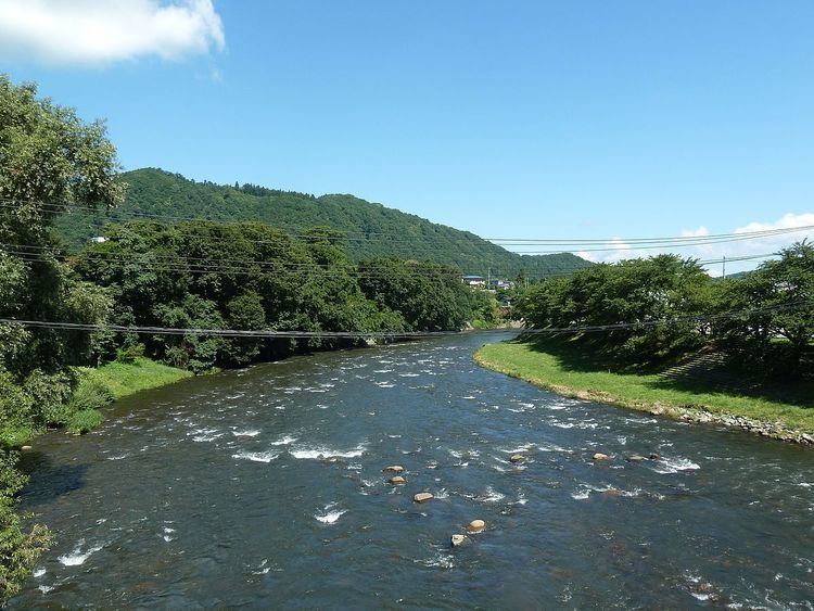
The Mabechi River (馬淵川, Mabechigawa) is a river located in eastern Aomori prefecture, in the Tōhoku region of northern Honshū in Japan.
Contents
- Mabechi river over flow by taifu
- Map of Mabechi River Kaigan Kawaragi Hachinohe shi Aomori ken Japan
- References
Map of Mabechi River, Kaigan Kawaragi, Hachinohe-shi, Aomori-ken, Japan
The river is 142 kilometres (88 mi) long and has a watershed of 2,050 square kilometres (790 sq mi).
The Mabuchi River rises from the Sodeyama Plateau in the Kitakami Mountains of northeastern Iwate Prefecture and flows to the northeast between the Kitakami Mountains and the Ōu Mountains through eastern Aomori Prefecture into the Pacific Ocean at Hachinohe, Aomori. The river flows through scenic Basenkyō Gorge in Ninohe, Iwate, which is located within the Oritsume Basenkyō Prefectural Natural Park. The Port of Hachinohe is located at the mouth of the river. The city of Hachinohe utilises water from the Mabechi River for industrial purposes.