
- elevation 726 m (2,382 ft) - average 8.5 m/s (300 cu ft/s) Basin area 1,829 km² | - location Plzeň City Length 106 km | |
 | ||
Sources | ||
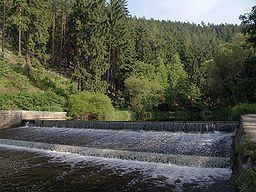
The Mže ( [ˈm̩ʒɛ]; German: Mies) is a 107 km long river in the Czech Republic. Its source is situated in the Griesbach Forest (726 metres), Germany, near the village of Asch, in the municipality of Mähring, Tirschenreuth district. It forms the state boundary for a short distance of 3 kilometers and then finally enters Czech territory. It passes through the towns of Tachov and Stříbro. At the confluence with the Radbuza, it forms the Berounka in Pilsen. Its major left affluent is Hamerský potok and the right affluent is Úhlava. There are two water dams on the Mže, Lučina and Hracholusky, both in the Tachov district. The basin area of the Mže is 1,828.6 km².
Map of M%C5%BEe, Plze%C5%88, Czechia
References
Mže Wikipedia(Text) CC BY-SA