
Elevation 92 m (302 ft) Area 6.92 km² Local time Thursday 7:40 PM Dialling code 06721 | Municipal assoc. Rhein-Nahe Time zone CET/CEST (UTC+1/+2) Population 2,839 (31 Dec 2008) Postal code 55424 | |
 | ||
Weather 12°C, Wind NE at 8 km/h, 69% Humidity | ||
Münster-Sarmsheim is an Ortsgemeinde – a municipality belonging to a Verbandsgemeinde, a kind of collective municipality – in the Mainz-Bingen district in Rhineland-Palatinate, Germany.
Contents
- Map of MC3BCnster Sarmsheim Germany
- Location
- Municipal council
- Coat of arms
- Buildings
- Natural monuments
- Festivals
- Vineyards
- Transport
- Education
- Honorary citizens
- References
Map of M%C3%BCnster-Sarmsheim, Germany
Location
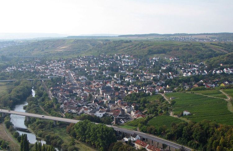
Münster-Sarmsheim lies between Bingen and Bad Kreuznach, on the river Nahe some two kilometres upstream from where it empties into the Rhine. The winegrowing centre belongs to the Verbandsgemeinde of Rhein-Nahe, whose seat is in Bingen am Rhein, although that town is not within its bounds.
Municipal council
The council is made up of 21 council members, counting the part-time mayor, with seats apportioned thus:
(as at municipal election held on 13 June 2004)
Coat of arms
The municipality’s arms might be described thus: Per fess, Or a minster with central block and wings on each side, each of the three with a gabled roof, each wing with a flanking buttress, and each roof ensigned with a cross, the one on the central block further ensigned with the head of an abbot’s staff sinister sable, all windows, two in the central block and one each in the wings, and the door in the central block of the field, and gules two arrows in saltire of the first surmounted palewise by a bunch of grapes slipped vert, the grapes three, four, three, two and one.
Buildings
Natural monuments
The Trollbachtal Nature Conservation Area harbours cliff formations from 285,000,000 years ago.
Festivals
Vineyards
Transport
Education
Münster-Sarmsheim has two kindergartens and its own primary school.