Area 50.08 km² | Local time Thursday 4:51 PM | |
 | ||
Weather 9°C, Wind SW at 11 km/h, 81% Humidity | ||
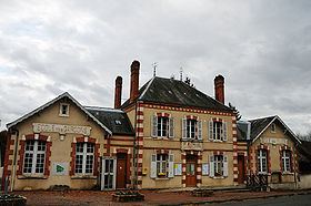
Ménétréol-sur-Sauldre is a commune in the Cher department in the Centre region of France.
Contents
Map of 18700 M%C3%A9n%C3%A9tr%C3%A9ol-sur-Sauldre, France
Geography
An area of lakes, forestry and farming comprising the village and a hamlet situated in the valley of the petite Sauldre river, some 16 miles (26 km) north of Bourges at the junction of the D924, D12 and the D79 roads.
The Petite Sauldre flows westward through the middle of the commune; the village lies on its right bank. The Rère flows northwestward, then southwestward, through the heavily-wooded southern part of the commune.
Sights
References
Ménétréol-sur-Sauldre Wikipedia(Text) CC BY-SA
