
Population (2008) 378 Elevation 185 m Local time Thursday 4:51 PM | Time zone CET (UTC+1) Area 5.67 km² | |
 | ||
Weather 9°C, Wind SW at 13 km/h, 84% Humidity | ||
Ménétréol-sous-Sancerre is a commune in the Cher department in the Centre region of France.
Contents
Map of 18300 M%C3%A9n%C3%A9tr%C3%A9ol-sous-Sancerre, France
Geography
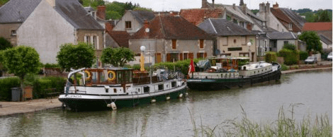
A winegrowing and farming village situated by the banks of the rivers Vauvise and Loire and the Loire lateral canal, some 26 miles (42 km) northeast of Bourges, at the junction of the D9 with the D920 and the D307 roads. The Sauvignon blanc grapes grown here are used for Sancerre AOC wines.
Sights
References
Ménétréol-sous-Sancerre Wikipedia(Text) CC BY-SA