
Time zone CET (UTC+1) Area 8.62 km² Local time Thursday 5:28 PM | County Szabolcs-Szatmár-Bereg Postal code 4975 Population 759 (2015) Area code 44 | |
 | ||
Weather 22°C, Wind W at 8 km/h, 50% Humidity | ||
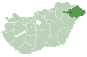
Méhtelek is a village in Szabolcs-Szatmár-Bereg county, in the Northern Great Plain region of eastern Hungary.
Contents
Map of M%C3%A9htelek, Hungary
Geography
It covers an area of 8.62 km2 (3 sq mi) and has a population of 759 people (2015).
History
The village was put on the map somewhat after catastrophic floods in the region in late 1960s. Valuable archeological finds---possibly going back to 5000---BC were uncovered during the reconstruction of the settlement.
References
Méhtelek Wikipedia(Text) CC BY-SA