
Time zone CET (UTC+1) Website www.matetelke.hu Local time Thursday 3:08 PM Area code 79 | County Bács-Kiskun Postal code 6452 Area 27.93 km² Population 475 (2015) | |
 | ||
Weather 23°C, Wind SW at 10 km/h, 37% Humidity | ||
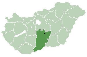
Mátételke (Croatian: Matević) is a village in Bács-Kiskun county, in the Southern Great Plain region of southern Hungary. It is part of Bácsalmási kistérség.
Contents
Map of M%C3%A1t%C3%A9telke, Hungary
Geography
It covers an area of 27.93 km2 (11 sq mi) and has a population of 617 people (2002).
Demographics
Existing ethnicities:
References
Mátételke Wikipedia(Text) CC BY-SA