
Population 6 (2011 census) Postal code 4178 | Postcode(s) 4178 | |
 | ||
Location 13 km (8 mi) from Brisbane GPO | ||
Lytton is an outer riverside suburb of Brisbane, Queensland, Australia.
Contents
Map of Lytton QLD 4178, Australia
Geography
It is 13 kilometres (8.1 mi) north-east of the Brisbane CBD, but travel by the railway or road is considerably longer.
History
A pilot station and a village were established at Lytton in 1859. It was most likely named after Edward Bulwer-Lytton (1803–73) who was the Colonial Secretary of State in 1858–59.
It would be two years before a road was surveyed from Norman Creek. A telegraph line was run from Brisbane to Lytton in 1862. During the years 1876–1908 a local post office was open.
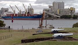
Due to Lytton location on the south-east bank of the Brisbane River at its seaward end Fort Lytton was built in the 1881 to guard the mouth of the Brisbane River. The fort had a moat and was an pentagonal structure concealed behind an embankment. It was fortified with two six inch disappearing guns, also in 1881 a rifle range was added.
Heritage listings
Lytton has a number of heritage-listed sites, including:
Present day
Although Lytton was once a town, it is now primarily commercial and industrial. It shares the same postcode as the Port of Brisbane. Caltex owns and operates the Lytton oil refinery in the north east of the suburb. The plant could produce 109,000 barrels per day in 2012.