Population 377 (2011 census) Civil parish Lythe Sovereign state United Kingdom | OS grid reference NZ846130 Local time Wednesday 6:44 PM | |
 | ||
Weather 10°C, Wind SW at 19 km/h, 69% Humidity | ||
Whitby 2016 runswick bay lythe saltwick bay sandsend whitby
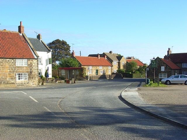
Lythe is a small village and large civil parish, in the Scarborough district of North Yorkshire, England, situated near Whitby within the North York Moors National Park.
Contents
- Whitby 2016 runswick bay lythe saltwick bay sandsend whitby
- Map of Lythe Whitby UK
- Yorkshire coast forest stage 1 self guided motorbike tour yorkshire coast lythe to whitby
- References
Map of Lythe, Whitby, UK
According to the 2011 UK census, Lythe parish had a population of 377, a reduction on the 2001 UK census figure of 465.
It was in the old North Riding and in the wapentake of Langbaurgh East.
St Oswald’s Church is a plain stone building in the Early English style. The stained glass east window is a memorial to the Rev. William Long, who was vicar from 1813 to 1858. Inside the church are memorials to the Phipps family, and to the Marquess of Normanby. The register dates from 1634. There is also a Wesleyan Methodist chapel.
Mulgrave Castle is the seat of the Marquess of Normanby. The estate also contains the ruins of a former residence known locally as Mulgrave Old Castle, which was an earthwork motte and bailey fortress.
Within the parish are the villages of Mickleby, Ugthorpe and Sandsend, and the hamlets of Barnby, Ellerby, Goldsborough, Hutton Mulgrave, Kettleness and Newton Mulgrave.
The old Red Lion public house has recently been renamed The Stiddy. A "stiddy" is an anvil packed full of gunpowder and fired like a cannon on special occasions, such as the birth of the Marquess' male heir, the jubilee, or the end of the Second World War.
There are a variety of amenities in the village including a local school, tennis courts and a retained fire station.
