
Basin countries United States Average depth 22 ft (6.7 m) Surface elevation 1,823 m | Surface area 1,400 acres (570 ha) Area 5.666 km² Mean depth 6.71 m | |
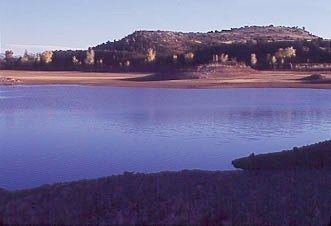 | ||
The Lyman Reservoir is the largest lake in the region. Lyman Lake State Park, is located in and administered by the Apache-Sitgreaves National Forest, attracts anglers, as well as campers and water skiers year-round.
Contents
Map of Lyman Lake, Arizona 85936, USA
LocationEdit
Lyman Reservoir is located 17 miles (27 km) north of Springerville.
DescriptionEdit
An irrigation impoundment on the Little Colorado River, Lyman Reservoir consists of 1,400 acres (570 ha) situated at 5,980 feet (1,820 m). The lake lies entirely within Lyman Lake State Park. Water levels fluctuate, but when full, the average depth is 22 feet (6.7 m), with a maximum depth of 57 feet (17 m). Lyman Reservoir is a warm water reservoir containing largemouth bass, channel catfish, green sunfish, carp and a few walleye.
AmenitiesEdit
The State Parks and Recreation Department maintains year-round visitor amenities. In the summer, there are interpretive tours of nearby petroglyphs.