
Population 121 (2011) Sovereign state United Kingdom Dialling code 01827 | OS grid reference SK249131 Post town SWADLINCOTE | |
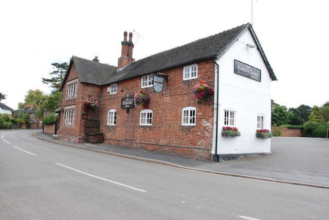 | ||
Lullington is a village and parish in the district of South Derbyshire, England. The population of the civil pariah at the 2011 Census was 121. It has an All Saints' Church, a village hall and a pub, the Colvile Arms (Charles Robert Colvile was living at Lullington Hall in the 1850s). In 1850, it had a school that was designed to take fifty children.
Contents
Map of Lullington, Swadlincote, UK
Together with neighbouring Netherseal, it is the southernmost village in Derbyshire.
History
Lullington is mentioned in the Domesday Book where it is then spelt Lullitune. The book says under the title of “The lands of the King's Thegns
In Lullington Auti had five carucates of land to the geld. There is land for five ploughs. There now Edward has of the king 21 villans and three bordars having four ploughs. There is a priest and one mill rendering 6s 8d (33p) and twelve acres of meadow. TRE as now worth four pounds.“