
Area 16,832 km² | ||
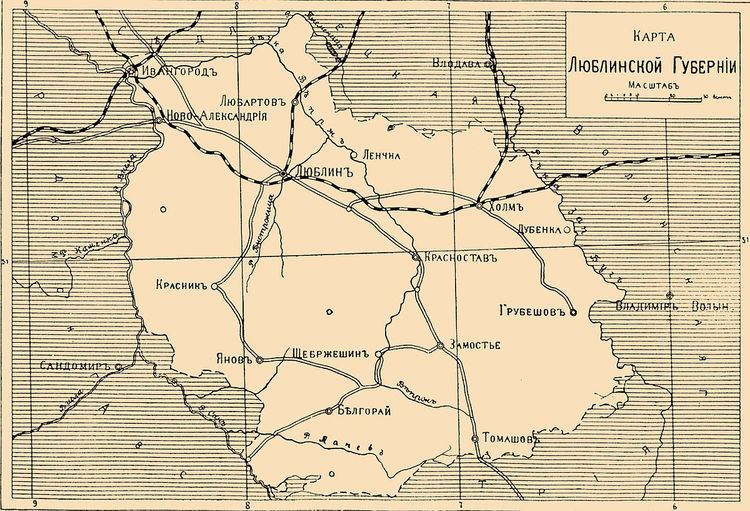 | ||
Lublin Governorate (Russian: Люблинская губерния), Polish: Gubernia lubelska) was an administrative unit (governorate) of the Congress Poland.
Contents
Map of Lublin Governorate, Poland
History
It was created in 1837 from the Lublin Voivodeship, and had the same borders and capital (Lublin) as the voivodeship.
Its lower levels of administration were also mostly unchanged, although renamed from obwóds to powiats. There were ten of those units named after their capital cities: biłgorajski, chełmski, hrubieszowski, janowski, krasnystawski, lubartowski, lubelski, puławski (from 1842: nowoaleksandryjski), tomaszowski and zamojski.
Reform of 1844 merged the governorate with Podlasie Governorate, until the 1867 reform which reversed those changes (although Podlasie Governorate was renamed to Siedlce Governorate). In 1912 some of the territories of the governorate were split off into the newly created Kholm Governorate.