
Car plates DLU | Area 712 km² | |
 | ||
Gminas Total 4 (incl. 1 urban)LubinGmina LubinGmina RudnaGmina Ścinawa Clubs and Teams Zagłębie Lubin, MKS Zagłębie Lubin Points of interest Park Wrocławski, Park Leśny, Pałac w Radomiłowie, Zamek rycerski, Rezerwat przyrody Skarpa St | ||
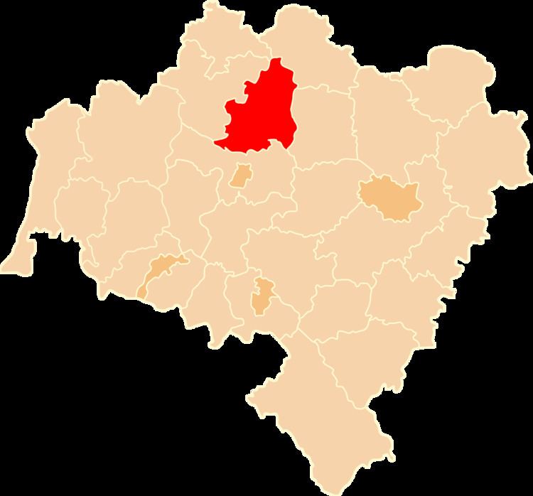
Lubin County (Polish: powiat lubiński) is a unit of territorial administration and local government (powiat) in Lower Silesian Voivodeship, south-western Poland. It came into being on January 1, 1999, as a result of the Polish local government reforms passed in 1998. The county covers an area of 712 square kilometres (274.9 sq mi). Its administrative seat and largest town is Lubin, and its only other town is Ścinawa.
Contents
Map of Lubin County, Poland
As at 2006 the total population of the county is 105,582, out of which the population of Lubin is 76,595, the population of Ścinawa is 5,934, and the rural population is 23,053.
Neighbouring counties
Lubin County is bordered by Głogów County to the north, Góra County to the north-east, Wołów County to the east, Legnica County to the south and Polkowice County to the north-west.
Administrative division
The county is subdivided into four gminas (one urban, one urban-rural and two rural). These are listed in the table below, in descending order of population.